Agras T100 in Remote Fieldwork: What Hyperspectral Science
Agras T100 in Remote Fieldwork: What Hyperspectral Science and a Third-Party Imaging Payload Reveal
META: A technical review of how Agras T100 can be extended for remote civilian fieldwork using hyperspectral insights, zoom imaging payloads, and high-precision sensor integration.
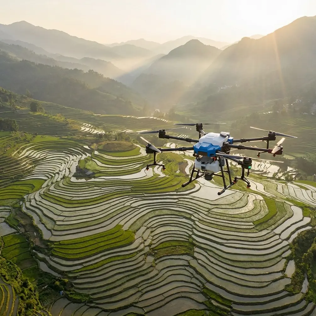
The Agras T100 is usually discussed in the language of agricultural productivity: flow rates, coverage efficiency, spray drift control, nozzle calibration, and the practical value of centimeter precision in difficult terrain. Those points matter. But they do not fully explain why the platform is attracting attention from operators working far beyond routine crop treatment.
What makes the T100 interesting in remote civilian fieldwork is not only its base airframe. It is the way the aircraft can sit at the intersection of two very different sensing worlds: analytical spectral data on one side, and long-range visual detail on the other. The reference materials here point toward exactly that split. One document focuses on hyperspectral imaging for soil interpretation. The other describes a third-party camera payload with 18x optical zoom, 1080P/30 fps output, sub-1-second autofocus, and a 3-axis stabilized gimbal with 0.03° control precision. Put together, they suggest a smarter way to think about the Agras T100 in remote operations.
For readers exploring the T100 for wildlife observation in isolated areas, habitat documentation, land condition assessment, or broad environmental site review, this combination deserves a close look.
The hidden value of the Agras T100 is platform stability, not just spraying
The Agras T100 enters most conversations as an agricultural workhorse. That is fair. Features tied to swath width, stable route execution, and RTK fix rate are central to its intended use. In crop work, those traits support repeatable coverage, cleaner overlaps, and more predictable droplet placement. In remote sensing and observation, the exact same traits create a different kind of advantage: they turn the aircraft into a repeatable airborne measurement platform.
That distinction matters.
If you are documenting a remote conservation zone or studying land changes around a waterway, the challenge is rarely just getting a drone into the air. The challenge is collecting information that can be compared over time. A frame captured today needs to align with one captured next week. A transect flown in the morning should be reproducible after rain, or during a seasonal vegetation shift. This is where centimeter precision and strong route consistency stop being abstract specifications and become operational tools.
A stable aircraft with strong positioning discipline gives more reliable image geometry. That benefits mapping. It also benefits interpretation. If an operator wants to compare bare ground patches, plant stress signatures, or changes around animal movement corridors, the quality of that comparison depends heavily on consistent flight execution.
Why hyperspectral thinking changes how you use a remote drone
One of the supplied references centers on hyperspectral imaging and its role in detecting what ordinary remote sensing often misses. That is not a small claim. The document explicitly notes that objects or conditions that cannot be identified in conventional remote sensing can become distinguishable in hyperspectral curves, increasing the amount of information available for inversion and analysis.
Operationally, that means a drone mission can move from “seeing the scene” to “reading the scene.”
The same source highlights an especially useful example: soil organic matter. It describes soil organic matter as a core indicator of soil fertility and notes that hyperspectral analysis can be used to understand present soil conditions for agricultural management. More specifically, cited research found that the absorption feature in soil reflectance spectra around 550 to 700 nm is largely driven by organic matter. That is one of the most concrete facts in the reference set, and it matters because it points to a wavelength region where field interpretation can become meaningfully more targeted.
For an Agras T100 operator, even if the aircraft is not carrying a full hyperspectral suite every day, this kind of spectral awareness changes mission planning. You begin to ask better questions:
- Are you collecting visual imagery only, or trying to infer surface condition?
- Are you observing vegetation health directly, or using vegetation as a proxy for what may be happening in the soil below?
- Are you flying because something looks unusual, or because spectral signatures suggest a problem before the eye can see it?
The source also notes that heavy metal monitoring has become more feasible as hyperspectral instruments have advanced. It describes two broad approaches: direct analysis from soil spectral data, and indirect inversion through vegetation spectral data when the ground is not directly visible. That second pathway is especially relevant in remote environments, where vegetation cover often blocks direct soil observation.
This is where the Agras T100 becomes more than a field sprayer with a camera attached. With the right third-party sensing setup, it can participate in workflows where visible imagery, multispectral logic, and eventually hyperspectral interpretation support each other.
A remote wildlife mission is not just about wildlife
The user scenario here is “capturing wildlife in remote” conditions. In practice, serious civilian wildlife work usually involves much more than spotting animals.
You may need to document habitat boundaries, identify stressed vegetation, inspect water access points, monitor erosion near nesting grounds, or map transitional edges between cultivated land and unmanaged terrain. That is why the references are useful even though one is about soil spectroscopy and the other about emergency mapping optics. They describe the two layers that matter most in remote field observation:
- Environmental condition detection
- Detailed stand-off visual confirmation
A visual payload alone can tell you that an area has changed. A spectral payload can help explain why.
If a sector of vegetation shows abnormal response, for example, the issue might be moisture, nutrient imbalance, contamination, soil composition, or disturbance. The hyperspectral reference makes clear that soil is a complex mixture of minerals, water, and organic compounds, all of which influence reflectance and absorption behavior. It also warns against simplistic interpretation, noting that different soils vary with climate, parent material, topography, biology, soil age, and human activity. That caution is not academic hand-wringing. It is a field reality.
For operators using the Agras T100 in remote environmental missions, this means one survey flight should not be mistaken for final truth. Spectral anomalies need context. Repeated flights, ground checks, and payload pairing matter.
The third-party accessory that broadens the T100’s role
The most intriguing practical clue in the references is the third-party iCam-V2 imaging payload.
According to the source, this visible-light day/night dual-mode camera offers 18x optical zoom, 1920×1080P at 30 frames per second, wide dynamic range up to 105 dB, and autofocus in under 1 second. It is mounted on a 3-axis gimbal with 0.03° control precision, and its operating temperature is listed at -10°C to 45°C. The payload weight is stated as under 600 g.
Those numbers are not decoration. They define how useful the system can be in the field.
An 18x optical zoom is valuable when you need distance without intrusion. In wildlife work, that can reduce disturbance around sensitive species. In environmental site review, it allows stand-off inspection of slope failures, damaged fencing, drainage channels, or inaccessible banks. The sub-1-second autofocus matters because remote conditions rarely hold still. Wind moves brush. Animals shift position. A delayed focus lock can turn a useful sighting into a blurred record.
The 105 dB dynamic range is another underappreciated specification. Remote scenes often contain brutal contrast: bright sky over shaded canopy, reflective water against dark soil, or low-angle light in dawn and dusk operations. Wide dynamic range helps preserve usable detail where ordinary video would lose either the highlight or the shadow.
The gimbal precision of 0.03° also deserves attention. On a stable platform, that level of control supports cleaner observation and more reliable visual evidence gathering. It is one thing to have zoom. It is another to hold the frame accurately enough that the zoom is meaningful.
If you are evaluating the Agras T100 for remote documentation, this is the kind of accessory that changes the conversation. It turns the aircraft from a broad-coverage machine into a platform that can both scan and inspect.
Pairing zoom optics with spectral intelligence
The best remote workflows do not force a choice between spectral analysis and visual confirmation. They stage them.
A sensible T100 mission architecture might look like this:
- First, use systematic route planning and strong RTK fix rate performance to fly repeatable lines over a remote area.
- Second, collect wide-area data aimed at detecting anomalies in vegetation or exposed ground.
- Third, return to specific coordinates with a precision hover and use a zoom payload for detail confirmation.
- Fourth, compare observations across time rather than relying on a single overflight.
This layered method reflects the logic embedded in the references. The hyperspectral document explains why conventional imagery may miss important distinctions and why vegetation can be used as an indirect indicator when soil is obscured. The camera document explains how a stabilized day/night zoom payload can support broad reconnaissance and fine-detail inspection.
In other words, one payload helps find the question. The other helps verify it.
Where the Agras T100 still needs discipline
There is a temptation to see a capable drone and imagine universal competence. That is a mistake.
The same soil spectroscopy reference that highlights the promise of hyperspectral sensing also warns that model transfer across different soils is difficult. Soil type, climate, terrain, biological factors, formation age, and human influence all alter physical and chemical characteristics. This means any remote sensing workflow built around the Agras T100 must respect local calibration.
That has practical implications:
- Multispectral or hyperspectral interpretation should be validated against real field samples where possible.
- Wildlife or habitat conclusions should not be drawn solely from a single visual pass.
- Sensor outputs need repeatable flight geometry and careful environmental notes.
- High-precision route performance is only useful if the data processing workflow is equally disciplined.
Even core agricultural habits carry over here. Operators who already understand nozzle calibration and spray drift are often better prepared for data collection than they realize, because they are accustomed to respecting environmental variables. Wind, angle, overlap, timing, and consistency all matter in imaging too.
Weather, durability, and remote operating reality
Remote work punishes fragile systems. That is why many operators looking at the Agras T100 care about ruggedness indicators such as IPX6K-level resilience. Even when a payload comes from a third party, the aircraft itself needs to tolerate field conditions that are never ideal: damp staging areas, dust, abrupt temperature changes, and transport abuse between sites.
The camera reference supports this real-world perspective. A payload that operates from -10°C to 45°C and uses a 3-axis stabilization assembly built from aviation aluminum alloy and nylon suggests practical field intent rather than lab-only deployment. That does not mean every accessory is automatically a perfect fit for the T100. Integration, balance, power, and control protocols always need verification. But it does show the market direction clearly: serious users want modular, specialized airborne tools, not just all-in-one defaults.
For teams planning remote observation or environmental review around the T100, this is the right question to ask: not “Can it fly there?” but “Can it carry the right sensing stack there repeatedly and safely?”
Why this matters now
The most useful reading of the references is not that the Agras T100 suddenly becomes a dedicated wildlife cinema platform or a hyperspectral research aircraft by default. It does not. The smarter takeaway is that the T100 sits in a growing category of robust work drones that can support more sophisticated civilian missions when paired with the right sensors and a disciplined workflow.
One reference shows that hyperspectral analysis can reveal information hidden from conventional remote sensing and points specifically to the 550–700 nm absorption behavior associated with soil organic matter. The other introduces a practical visual payload with 18x optical zoom, 1080P/30 fps, 0.03° gimbal control precision, and under-1-second autofocus. Together, they outline a compelling field model for the Agras T100:
- broad-area repeatable coverage,
- anomaly detection informed by spectral science,
- detail verification from stand-off distance,
- and more reliable interpretation in remote terrain.
That is relevant whether your target is habitat documentation, vegetation stress around animal corridors, wetland edge monitoring, or inaccessible rural site inspection.
If you are sorting through payload strategies or remote mission design for the T100, it helps to discuss the sensing workflow before choosing hardware. For technical questions on integrating remote-observation payloads into a field-ready setup, you can message a specialist here.
The Agras T100 is often treated as a single-purpose machine. The references suggest a better view. It is a stable, precise aerial platform whose real ceiling depends on the intelligence of the sensors attached to it and the rigor of the operator behind it.
Ready for your own Agras T100? Contact our team for expert consultation.