
Agras T100 on Coastal Delivery and Field Work
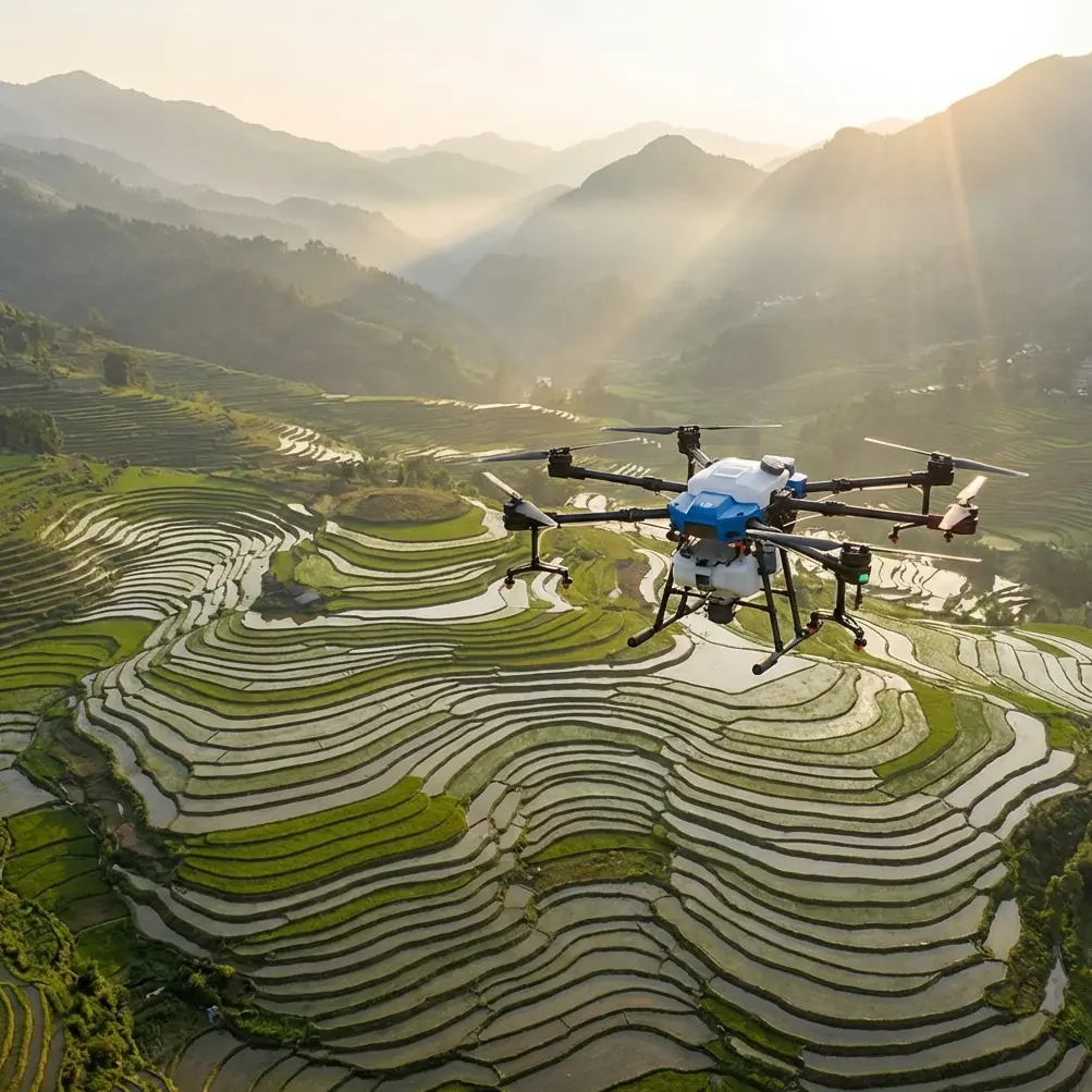
Agras T100 on Coastal Delivery and Field Work: What Actually Matters in Harsh Edge Environments
META: A consultant-level case study on Agras T100 operations in coastal conditions, covering antenna placement, redundancy logic, obstacle-sensing limits, drift control, RTK stability, and why edge-environment planning matters.
Coastal work exposes every weak assumption a drone team makes.
That is true whether the Agras T100 is being used around shoreline agriculture, transport runs between exposed properties, or support tasks across salt-heavy, wind-variable terrain. Inland flights can hide sloppy planning. Coastlines do the opposite. Wind shifts faster. Reflection and glare complicate perception. Moisture and salt push hardware harder. Range discipline suddenly matters. So does basic airframe logic: what the aircraft can detect, what it cannot, and what backup systems are really designed to do.
I want to frame this through a practical operating lens rather than a feature recital. The most useful reference point here comes from a training document on drone sensing and redundancy. It highlights two ideas that have direct operational value for anyone evaluating Agras T100 work near the coast.
First, a forward TOF sensor mounted high on the aircraft does not guarantee complete obstacle awareness. The document gives a very specific warning: if an obstacle sits below the sensor’s line but at the same height as the propellers, it can still stop the aircraft’s path even if the TOF geometry misses it initially. Second, the same material explains why high-end drones rely on double-backup design in critical systems such as batteries, IMU, barometric altitude sensing, and signal transmission. It even uses a simple reliability analogy: a truck axle may only need one tire to keep moving, yet carries at least two on one side because redundancy buys margin.
Those are not abstract engineering notes. They shape how an Agras T100 should be deployed on coastlines.
The coastline problem is not one problem
People often talk about “coastal operations” as if that means salt air and little else. In reality, it is a layered environment.
You may have:
- open wind coming off the water
- low contrast visual backgrounds
- poles, wires, fencing, and netting at awkward heights
- uneven embankments
- reflective wet ground
- narrower safe approach lanes
- long, exposed signal paths
- loading and takeoff zones with little natural shelter
For an Agras T100 operator, this creates a strange mix. You may have excellent open sky for RTK performance and strong line-of-sight in one direction, then poor approach geometry and high drift pressure a few meters later. That is why coastal delivery support or shoreline spraying cannot be reduced to a single spec like swath width or payload efficiency. The mission quality comes from system discipline.
What the TOF lesson means for the T100 in real operations
The reference document’s point about the forward TOF sensor being mounted above the obstacle line is one of those details many teams ignore until they have a near miss.
The lesson is simple: do not confuse “obstacle sensing present” with “all obstacles are reliably covered.”
On a coastline, that matters because many hazards are thin, low, or irregularly positioned relative to the aircraft body and rotors. Think guy wires near pumps, protruding posts, coastal fencing, trellis edges, nets, or storm-damaged structures. If something sits below the effective detection path of a forward sensor but still intrudes into the rotor plane, your safety margin is smaller than it looks on paper.
Operationally, this changes three things for an Agras T100 workflow:
1. Approach corridors need to be mapped by rotor envelope, not camera confidence
A clean visual lane is not enough. The question is whether anything enters the propeller-height space across the aircraft’s full forward path. In coastal environments, this is especially relevant around dunes, embankments, and utility infrastructure where object height changes abruptly over short distances.
2. Automated avoidance should never replace route shaping
The training material describes a simple logic where the aircraft can auto-land when a TOF sensor detects an obstacle or when it reaches the obstacle zone. That is useful as a fallback, but fallback logic is not route design. For the T100, especially during low-altitude productive work, route planning should be built around known clearances before the aircraft ever needs protective behavior.
3. Low-angle hazards deserve preflight attention
Teams spend plenty of time checking weather and payload, yet often rush past the ugly stuff at shoulder height. Near coastlines, that ugly stuff includes ropes, edge rails, irrigation lines crossing access points, and bent metal supports. These are exactly the objects that create the mismatch between what a sensor sees and what a rotor can hit.
Redundancy is real protection, but not magic
The second major takeaway from the source material is the value of backup systems. It explicitly notes dual-redundant design in core components such as battery, IMU, barometric altitude sensing, and signal transmission. It also mentions a dual communication path between ESC and flight control so control instructions can still pass if the primary path drops.
For an Agras T100 buyer or operator, that matters because coastal jobs are hostile to continuity. Signal quality can fluctuate. Moisture and contamination increase long-term stress. Takeoff zones may be improvised. Recovery windows can be tighter than on a flat inland field.
A redundant architecture helps because it buys time and options when one element underperforms or fails. If one battery path or sensing channel has a problem, another can sustain safe control. If one communication path drops, a backup route may preserve command flow. In practical terms, that is what separates a recoverable event from a bent airframe.
But the same source also gives a caution many marketing sheets never emphasize: failures are not always independent. It uses the example of a multi-engine aircraft where one engine fire may trigger broader failure. That warning carries over nicely into drone operations. Redundancy reduces risk, but common-cause hazards remain.
On coastlines, common-cause hazards include:
- salt contamination across multiple connectors
- poor battery handling in a damp loading zone
- aggressive route choices that stress the entire aircraft
- bad antenna placement that degrades both control confidence and operator decision-making
- launching too close to clutter where several systems are challenged at once
So the right mindset with an Agras T100 is not “the aircraft has backups, so we can push.” It is “the aircraft has backups, so disciplined planning has a better chance of ending well when conditions get messy.”
Antenna positioning advice for maximum range
If I had to give one field note to every coastal T100 crew, it would be this: stop treating antenna orientation as an afterthought.
Open shorelines tempt people into assuming range will take care of itself. Sometimes it does. Sometimes the water-side geometry actually creates a misleading sense of security because there are fewer buildings and the aircraft appears visually obvious. Then the pilot stands beside a vehicle, a metal tank, a pump shed, or stacked batteries, and quietly degrades the control link.
For the best practical range behavior, keep the control antenna faces presented toward the aircraft’s flight area rather than pointing the antenna tips directly at it. Elevate the operator position if possible, preserve clean line-of-sight, and avoid standing with the controller backed against large metal structures or parked equipment. If the route follows a coastline, reposition yourself as the mission moves instead of trying to hold a single static control point for convenience.
That last part matters more than many teams realize. Range is not only about transmitter power. It is about geometry. Along a curved shoreline or segmented field edge, a poor operator position can turn a straightforward route into a link-quality compromise.
If your team is configuring a coastal T100 workflow and wants a second opinion on layout, relay placement, or controller stance, you can share your setup here: send a field diagram and mission notes.
Why drift control becomes a planning issue, not just a weather issue
The provided news reference is about overcast portrait photography, which seems unrelated at first glance. It argues that cloudy conditions are often misunderstood as easy because the light is soft, when in fact diffuse light from all directions removes contrast and makes subjects look flat and lifeless if the photographer does not know how to control it.
That same logic applies surprisingly well to coastal drone operations.
Operators often misread “soft” conditions. A gray sky, moderate air, or visually calm shoreline can look forgiving. But appearances flatten reality. Diffuse visual conditions can make depth cues weaker. Horizon separation can feel vague. Moisture and haze can make objects read softer than they are. In spraying scenarios, gentle-looking air can still carry fine droplets farther than expected if the movement is broad and unstructured.
So for the Agras T100, spray drift management near coastlines should never rely on the operator’s casual visual impression of the environment. It should be grounded in nozzle calibration, droplet behavior, flight height discipline, and realistic lateral drift expectations. If you have a wide planned swath width, you need to confirm that coverage assumptions still hold under that day’s air movement rather than assuming broad, even application.
That is where centimeter precision and a stable RTK fix rate become more than buzzwords. Along irregular coastal boundaries, precise track repeatability helps reduce overlap waste and edge misses. It also helps crews hold tighter exclusion margins near water, access roads, or sensitive perimeter zones. A robust RTK solution does not solve drift by itself, but it gives the aircraft a cleaner positional reference so drift management decisions are not stacked on top of navigational slop.
The best coastal T100 missions are conservative in the right places
I have seen teams obsess over output numbers and ignore the handful of variables that actually decide whether the day runs cleanly.
The variables that matter most near the coast are usually these:
- launch and recovery zone quality
- known obstacle height relative to rotor level
- control-link geometry
- battery handling discipline
- drift margins at the boundary
- confidence in RTK stability
- whether the operator has a realistic fallback when one subsystem degrades
Notice what is absent from that list: bravado.
An Agras T100 can be a highly capable platform in exposed environments, but capability only becomes productivity when the operator respects system limits. The training document makes this plain. Sensor-based protection has blind spots. Redundant design raises reliability. Neither one eliminates risk. That is exactly the mindset coastal work demands.
A case-study mindset for shoreline deployment
If I were auditing a T100 shoreline mission tomorrow, I would ask for six things before the first flight:
- A map of obstacle heights that specifically identifies anything that could intersect the propeller plane even if it is not visually dominant.
- Proof that nozzle calibration and boundary drift assumptions were checked for that site, not copied from an inland template.
- The expected RTK behavior at the work area, including known shadow zones or fix instability points.
- The operator’s controller and antenna positioning plan as the aircraft moves down the coastal line.
- A recovery workflow for communication degradation that does not depend on wishful thinking.
- A contamination-control routine for batteries, connectors, and exposed surfaces after salt-heavy sessions.
That is how professionals keep an Agras T100 productive on the edge of water and weather. Not by pretending coastal work is impossible, and not by pretending the aircraft is invulnerable.
The real standard is simpler. Understand what the machine can back up. Understand what it cannot see. Understand where your signal is strongest. Then build the mission around those truths.
Ready for your own Agras T100? Contact our team for expert consultation.