
Agras T100 Best Practices for Coastal Delivery Routes in Com
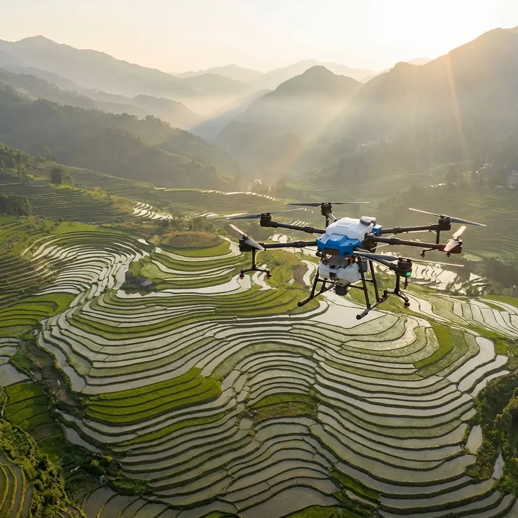
Agras T100 Best Practices for Coastal Delivery Routes in Complex Terrain
META: Practical Agras T100 operating insights for complex coastal routes, with altitude, obstacle logic, precision flight considerations, and why training-style sensor discipline matters in real field work.
Coastal delivery work looks simple on a map. In the air, it rarely is.
A shoreline route can shift from open exposure to clutter in seconds: sea walls, utility poles, cliff edges, storage yards, wind funnels between buildings, and reflective surfaces that confuse depth judgment. If you are evaluating the Agras T100 for this kind of civilian logistics task, the real question is not whether the aircraft can fly the route. It is whether your operating method is disciplined enough to keep the route repeatable when terrain, airflow, and obstacle spacing stop behaving like a clean test field.
That is where an unexpected lesson from training and policy material becomes useful.
One reference from a DJI TT education document describes a very specific indoor autonomy exercise: the drone climbs to 1.5 meters, measures its distance to the ground, stores that value as a variable, then uses further height measurements to understand a new surface. Another section breaks obstacle logic into simple increments: move forward 20 centimeters at a time, pause, check whether an obstacle is within 60 centimeters, then stop, turn, return, or sidestep based on sensor feedback. At first glance, that sounds far removed from an Agras T100 flying along a rugged coast. It is not. Those numbers reveal something operationally valuable: good autonomous flight is not built on speed first. It is built on measured spacing, verified altitude references, and conservative trigger distances.
For complex coastal delivery, that matters more than headline performance.
The real problem: coastal terrain punishes lazy altitude choices
Most route instability near the coast starts with altitude selection. Operators often think in broad categories — low, medium, high — when they should be thinking in relation to terrain transitions, structures, and sensor reliability.
Fly too low and the aircraft can be pulled into turbulent air shed by rocks, berms, sea walls, containers, vegetation, or rooflines. Fly too high and you may reduce route efficiency, lose some of the practical benefit of terrain-following precision, and introduce wider path deviations in crosswinds. If the aircraft is carrying liquid in an agricultural context, poor altitude also affects spray drift, swath width, and nozzle behavior. In logistics or transport-style movement, it affects clearance confidence, battery use, and path consistency.
The useful insight here is that optimal altitude is not a fixed number for every section of coast. It is an operating envelope tied to obstacle density and terrain contrast.
That sounds obvious. The part many teams miss is how to operationalize it.
Start with a “measured reference” mindset, not a “set-and-forget” altitude
The training document’s 1.5-meter climb-and-measure exercise is basic, but the principle scales upward well: establish a reference surface first, then evaluate what changes beneath you. In an Agras T100 workflow, that means you should avoid treating takeoff altitude as your true safety baseline for a long coastal leg.
Instead, build each route around three altitude layers:
Departure reference altitude
The initial stable altitude after launch, used to confirm aircraft response, wind behavior, and sensor health.Transit working altitude
The section-specific altitude used for moving along the route while preserving obstacle margin.Clearance transition altitude
A temporary higher band used at chokepoints: headlands, stacked infrastructure, cliffside bends, elevated cables, and loading areas with variable vertical clutter.
The educational source uses variable assignment to remember measured height differences between the ground and another surface. That is exactly the mental model T100 crews need. Coastal routes are not one surface. They are a chain of changing surfaces: docks, embankments, roads, terraces, roofs, elevated pads, and sloped access tracks. If your team does not consciously separate those reference states, your “safe altitude” can become unsafe without any warning from your own assumptions.
Why short-step obstacle logic matters on long routes
The same training material describes a loop where the drone advances 20 cm, checks distance, and exits when TOF measurement falls below a threshold such as 500 mm or when an obstacle is identified within 60 cm. No one is suggesting you run an Agras T100 over the coast in literal 20 cm movement blocks. The operational significance is elsewhere: obstacle avoidance works best when the aircraft is allowed to update decisions in small, deliberate increments rather than committing too early to a long uninterrupted line.
For coastal delivery planning, that translates into route segmentation.
Break the mission into micro-zones:
- open shoreline exposure
- built-up access corridor
- terrain bend or cliff-shadow section
- drop or pickup approach
- departure corridor
Each zone should have its own assumptions about wind shear, obstacle profile, GNSS quality, and acceptable speed. This is also where RTK fix rate and centimeter precision become more than brochure phrases. Precision only helps if the route logic respects where precision is most needed. Along a broad open stretch, route geometry may be forgiving. Near retaining walls, utility structures, or narrow service lanes, a degraded fix or loosely managed transition can have outsized consequences.
If your T100 operation relies on one continuous line with one uniform behavior model, you are asking the aircraft to solve a terrain problem you should have solved in planning.
Optimal flight altitude insight for coastline delivery
Here is the most practical altitude guidance I give teams for this scenario:
Use the lowest altitude that preserves a comfortable vertical and forward clearance margin through the most cluttered section of the current route segment, not the lowest altitude that works over the easiest section.
That sounds like a subtle distinction. It changes everything.
Over open coastline, the temptation is to descend for efficiency. But if that same segment feeds directly into a sea-wall bend, pier equipment zone, or rising bluff edge, the better move is often to keep a slightly higher, more stable transit band so the aircraft is not making abrupt vertical corrections under wind pressure just as the route gets complicated.
A low route can look efficient on paper and become messy in execution. A slightly higher but cleaner route often produces better repeatability, fewer intervention moments, and safer energy management.
For agricultural users adapting T100 methods between spray work and coastal transport around farm-adjacent shorelines, this has a second benefit: altitude discipline also supports more predictable nozzle calibration outcomes when the aircraft returns to application tasks. Pilots who learn to think in measured vertical relationships tend to manage both payload behavior and terrain margins better.
Borrow from classroom obstacle behavior, but apply it like a professional
Another reference passage describes a drone encountering a wall, flashing a red light, turning around, then flying back 100 centimeters before landing. Again, the exact move is simplistic. The deeper lesson is excellent: predefine the response to a blocked path before the aircraft reaches it.
In complex coastal terrain, every mission should include at least one of these response templates:
- Return-on-block for narrow or dead-end shoreline access paths
- Lateral bypass when an obstacle has safe clearance on one side
- Vertical bypass when side extension behaves like a wall and rising above it is safer
- Abort-and-hold for ambiguous sensor readings or unstable wind at a transition point
That last point matters because one part of the training text notes that some obstacles extend so far left and right that the drone may need to pass above rather than around them. Coastal work presents exactly that pattern: long fences, sea walls, ridge faces, stacked breakwater elements, and industrial perimeters. Teams that only think in left-right avoidance tend to trap themselves operationally. Vertical options must be planned in advance, not improvised at the last second.
Precision, weather resistance, and why ruggedness is not a planning substitute
Many operators considering the Agras T100 are drawn to rugged platform traits and precision capabilities. Fair enough. In a coastal environment, any discussion usually circles around moisture, salt, dirt, and washdown practicality, which is where a term like IPX6K starts showing up in buying conversations.
That kind of ingress protection matters. It does not solve route discipline.
Salt exposure, mist, and blowing particulate create operational fatigue over time, but most mission problems still begin with poor decision structure: flying too low through turbulent edges, trusting one altitude profile across multiple terrain states, or failing to define an obstacle response hierarchy. Durable hardware helps the aircraft survive a harsh setting. It does not make a harsh setting simple.
The same goes for advanced sensing. If your broader operation also uses tools such as multispectral mapping on adjacent agricultural land, do not let that analytical sophistication create false confidence in the logistics leg. Survey intelligence is valuable, but delivery routes still demand live airspace judgment, obstacle spacing logic, and conservative segmentation.
The policy angle many people overlook
The policy reference from Henan is old, but it captures an enduring truth about agricultural drone adoption: structure accelerates operational maturity. In that material, 130 plant-protection drones were subsidized in 2014, and support was set to continue with stronger emphasis in 2015. There is also a notable funding detail: eligible buyers could receive one-third from a provincial special fund and one-third from agricultural machinery purchase support, effectively reducing the direct outlay to one-third.
Why mention that in an article about the Agras T100 and coastline delivery?
Because broad adoption programs tend to do more than move units. They normalize training, procedural thinking, fleet management, and standardized workflows. That is relevant here because the T100 should not be evaluated only as a machine. It should be evaluated as part of an operating system. The better your procedure culture, the more value you extract from precision navigation, route repeatability, and obstacle handling. Coastal missions expose weak operating systems quickly.
Teams moving into T100 deployment often focus on payload, route length, and terrain maps. The stronger operators also ask: what is our threshold logic, what is our altitude doctrine, and what is our preplanned action if the route becomes nonviable at the chokepoint?
Those are the questions that separate routine delivery from recurring rework.
A practical route method for the Agras T100 in this scenario
If I were building a first-pass operating standard for complex coastline work, it would look like this:
1. Establish a conservative transit altitude first
Do not optimize for the easiest stretch. Optimize for continuity through the hardest transition within that segment.
2. Confirm precision quality before committing
If your operation depends on RTK fix rate, verify stable positioning before entering narrow terrain corridors. “Good enough” over open water-adjacent land may not be good enough beside walls or steep rises.
3. Treat obstacles as categories, not surprises
Use a response tree:
- pass laterally
- pass vertically
- reverse path
- hold and reassess
4. Keep route zones short
The educational logic of repeated checks every short interval is the right mindset. Your T100 route should have frequent decision opportunities, even if they are software-defined geospatial segments rather than literal stepwise pauses.
5. Separate delivery altitude from application altitude
If the aircraft is used across multiple roles, do not let assumptions from spraying dictate transport height. Swath width, spray drift, and nozzle calibration belong to one operational mode. Obstacle margin and wind stability dominate the other.
6. Rehearse terrain transitions in low-risk conditions
Cliff-edge bends, dock approaches, and built shoreline entries should be proven when environmental variability is modest, not on the first day of a demanding schedule.
If you need a second set of eyes on route planning logic for a T100 coastal workflow, I usually recommend teams share a simplified terrain sketch and mission objective first through direct WhatsApp coordination.
One final perspective on altitude
The best altitude for coastal delivery is rarely the minimum survivable height. It is the height that gives the aircraft time to make good decisions.
That is the connecting thread across the reference material. A photography article talked about recording time and emotion through images; odd source for drone operations, maybe, but there is a useful parallel there. Good field work also depends on seeing transitions before they are already behind you. The classroom drone examples reduce flying into small checks and measured responses. The policy example shows what happens when a sector matures through structure. Put those together, and a better Agras T100 operating philosophy appears:
Measure first. Segment the route. Preserve decision space. Use altitude as a stability tool, not just a clearance number.
That is how complex shoreline delivery starts becoming routine.
Ready for your own Agras T100? Contact our team for expert consultation.