
Agras T100 Field Report: High-Altitude Crop Inspection
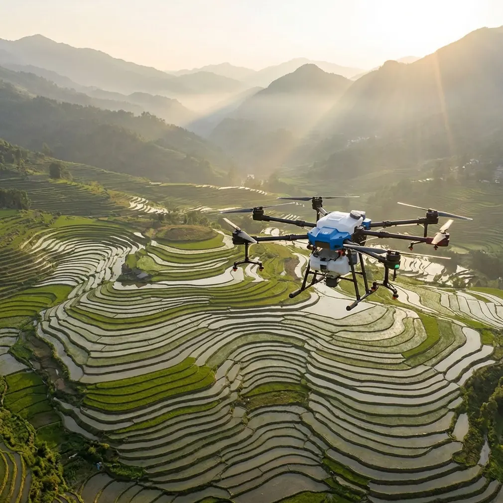
Agras T100 Field Report: High-Altitude Crop Inspection, Signal Discipline, and Camera Settings That Actually Hold Up
META: A field-focused Agras T100 article for high-altitude crop inspection, covering EMI mitigation, RTK stability, camera workflow, sensor logic, and practical image capture decisions in mountain terrain.
High-altitude field inspection exposes every weakness in an agricultural drone workflow. Thin margins become visible fast: unstable positioning, changing light, wind pushing your line off target, and electromagnetic interference that shows up just when terrain gets complicated. The Agras T100 enters that environment with a very specific challenge. It is not enough for the aircraft to fly. It has to produce inspection data that a farm manager can trust when deciding on spraying routes, drift risk, crop stress zones, and access strategy.
That is why a real field report matters more than a spec-sheet summary.
In mountain and plateau agriculture, the inspection mission usually starts before the props spin. You look at elevation changes, the shape of the terraces, likely radio shadows, reflective surfaces, nearby power infrastructure, and whether the site will allow a stable RTK fix rate throughout the full route. High-altitude work punishes assumptions. A line that looked clean on the tablet can become noisy once the aircraft begins crossing ridges or skirting irrigation hardware.
The first operational lesson with the T100 in these conditions is simple: signal management is part of inspection quality, not just flight safety. When electromagnetic interference begins to affect the link, antenna adjustment is not a cosmetic tweak. It changes whether the drone maintains consistent command responsiveness and whether the positioning solution stays usable enough for repeatable passes. On sloped ground, even a small loss in link quality can distort the relationship between what the operator sees and where the aircraft actually is. That matters when you are trying to compare crop vigor from one lane to the next or line up a later application mission with centimeter precision.
A lot of teams talk about RTK in broad terms. In steep agricultural terrain, the practical issue is not whether RTK exists on the aircraft. The issue is whether the RTK fix rate remains stable while the drone turns near contour edges, passes beside metal structures, or transitions between open sky and partial obstruction. If the fix rate drops too often, your inspection mosaic loses consistency. Then every later decision becomes weaker, from swath width planning to nozzle calibration zones.
That is where disciplined setup starts paying off. The T100 operator should treat antenna orientation as a live field variable, especially when interference is suspected. Rather than blaming the site in general, experienced crews isolate the problem. They watch where signal degradation begins, note heading changes, and adjust the antenna relationship to the aircraft accordingly. In practice, this often restores cleaner communication without forcing a mission restart. On high-altitude farms where weather windows are short, saving one aborted inspection can protect the entire day’s agronomic schedule.
The second lesson is visual capture. Inspection is not only about sensors and maps. It is also about whether the imagery remains usable when light shifts by the minute. Here, an idea borrowed from still photography turns out to be surprisingly effective for drone field documentation: aperture priority paired with Auto ISO. The underlying logic is straightforward. You lock aperture first to control depth of field, then let the camera compensate for changing light by adjusting sensitivity automatically. That combination was described in the reference material as especially useful for landscapes, street scenes, flowers, and sunrise or sunset work. Those are not agricultural categories on paper, but the lighting problem is identical. High-altitude fields can swing from bright reflection to cloud shadow in a single pass.
Why does this matter on an Agras T100 inspection? Because field review often depends on small visual cues: patchy canopy density, irrigation irregularities, tramline visibility, lodging edges, or signs that one block should be separated from the next during application planning. If the operator chases exposure manually every time the sun drops behind a ridge, the mission slows down and the image sequence becomes inconsistent. Aperture priority with Auto ISO reduces that workload. It is the same reason the source described the setup as helpful when light changes quickly and you do not want to keep adjusting parameters.
There is a second benefit. In crop-edge documentation, especially where access roads, workers, equipment, or tree lines enter the frame, a larger aperture can help isolate the subject area by softening a distracting background. The reference explicitly pointed out that a wide aperture can blur the background and emphasize the main subject in portrait or casual shooting. Translate that into farm operations and the value becomes clear: when documenting a suspect patch, washout zone, or drift-sensitive border, subject separation makes your review faster. You are not making art. You are making interpretation easier.
None of this replaces agronomic sensing. If your T100 workflow includes multispectral data, then visible imagery becomes one layer in a broader diagnostic stack rather than the whole story. Multispectral inspection is particularly useful in high-altitude production because visual color alone can lag behind physiological stress. You may see a field that looks generally healthy from standard footage while multispectral patterns already show uneven vigor on upper and lower terraces. The useful move is to combine the two. Use multispectral to identify the anomaly, then use stable visual capture to verify whether the pattern is tied to water, stand density, access damage, or localized disease pressure.
That synthesis is where a field inspection earns its keep.
Another point operators sometimes underestimate is environmental durability during inspection days that mix dust, moisture, and repeated setup changes. IPX6K-level protection matters not because a brochure says so, but because mountain agriculture rarely gives you a clean launch pad. Mud on boots, mist around hoses, residue from previous mixing areas, and fast packing between locations all create conditions where a more protected airframe and system architecture reduce interruptions. The more time you spend wiping connectors and troubleshooting exposure to the environment, the less time you spend collecting usable field intelligence.
Yet durability alone does not solve the mission. Reliability thinking matters too. One of the reference documents discussed parallel, series-parallel, and voting reliability models, including a “n choose k” logic where a system continues functioning if enough units still work. That may seem far removed from a crop inspection sortie, but the design logic is highly relevant. High-altitude operations reward systems and workflows that are not fragile. You want positioning, sensing, control, and imaging routines that do not collapse because one variable degrades briefly. In operational terms, that means building redundancy into your process even when the aircraft hardware is fixed.
For example:
- You do not rely on one indicator of mission quality; you cross-check telemetry, RTK stability, and image consistency.
- You do not trust one pass over a complex slope if interference was observed; you repeat the segment with improved antenna alignment.
- You do not infer spray planning solely from a visual map; you compare topographic behavior, crop variability, and probable drift corridors.
That is reliability applied as method rather than mathematics.
And spray drift deserves attention early, even in a mission framed as inspection rather than application. The point of inspection is often to shape what comes next. In high-altitude fields, drift risk can increase near exposed ridges, broken canopy edges, and abrupt elevation transitions. If the T100 inspection reveals wind-funneled corridors or inconsistent crop density at border zones, those observations should feed directly into later route design, droplet strategy, and swath width decisions. A map is only useful if it alters behavior. Good inspection reduces avoidable overreach before the first tank is ever loaded.
The same goes for nozzle calibration. Calibration is often treated like a maintenance box to tick, but inspection data can tell you where calibration quality matters most. If one hillside block is significantly more variable than the others, or if plant height changes sharply between terraces, then your application setup needs tighter discipline there. Inspection does not calibrate the nozzles by itself. It tells you where poor calibration will cost the most in coverage uniformity.
One thing I appreciate in difficult terrain is when the pilot thinks like an image editor and a radio technician at the same time. That sounds abstract until you watch a high-altitude mission unravel. Light changes. The aircraft turns across a slope. The signal weakens near a metal installation. The operator ignores the antenna angle and fiddles with exposure manually. Now both the link and the image record are compromised. A stronger operator makes cleaner choices: maintain framing logic, let Auto ISO absorb the light swing, preserve aperture for the visual goal, monitor the RTK fix rate, and correct antenna orientation before the interference becomes a larger problem.
That sequence is boring in the best possible way. It keeps the mission usable.
The educational drone reference in the source material also offered an indirect reminder worth carrying into Agras operations. It described a compact quadrotor with a high-definition camera, stable flight image transmission, and a sensor set including TOF ranging, attitude measurement, acceleration, vision, and barometric altitude, all supported by strong flight-control algorithms. The aircraft in that document was built for learning, not heavy agricultural work, but the principle scales up cleanly: stable flight and layered sensing are not luxuries. They are what allow operators to focus on interpretation rather than basic aircraft correction. On a high-altitude T100 mission, the same philosophy applies. The more stable the aircraft behavior and the more coherent the sensing stack, the better the inspection output becomes under pressure.
That is also why training matters. Crews should rehearse interference response before going to a complex site. Not in theory. In drills. Which direction should the pilot test first when signal quality drops? How will the visual observer call terrain masking risks? At what threshold does the team pause to recover RTK integrity instead of pushing through? These are not glamorous questions, but they separate a clean field report from a folder full of questionable files.
If you are building a repeatable T100 inspection routine for mountain farms, I would structure it like this:
Start with terrain and interference assumptions, not with camera assumptions. Establish where link quality is likely to change. Confirm your RTK behavior early. Then configure the camera for consistency rather than perfectionism. Aperture priority and Auto ISO are effective because they reduce pointless workload while preserving control over depth of field. Use multispectral where available to flag non-obvious stress. Watch for signs that affect later application performance, especially spray drift exposure, canopy variability, and the sections where nozzle calibration accuracy will matter most. If interference appears, treat antenna adjustment as a first-line response, not an afterthought.
That approach gives the Agras T100 a more meaningful role. It becomes more than a field overflight platform. It becomes a decision instrument.
And for operators working remote plots with narrow timing windows, that distinction is everything. A mountain inspection mission is successful only when the data survives scrutiny back at the truck, back at the office, and later during the spray plan. Sharp footage alone is not enough. Stable positioning alone is not enough. You need the link, the light handling, the route logic, and the agronomic interpretation to support each other.
If you’re comparing workflows for your own terrain and want to discuss EMI handling or inspection setup details, send your field scenario here: https://wa.me/85255379740
Ready for your own Agras T100? Contact our team for expert consultation.