Agras T100 for Windy Vineyard Inspections
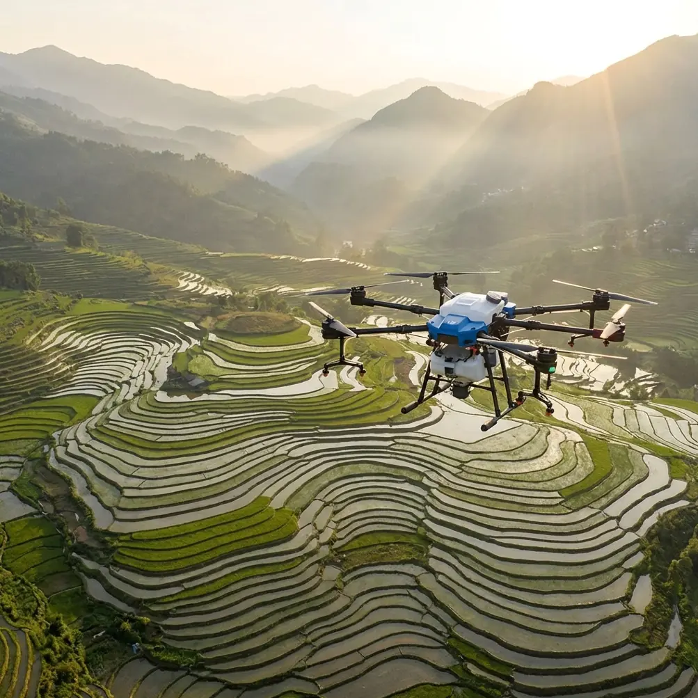
Agras T100 for Windy Vineyard Inspections: The Flight Altitude That Protects Data Quality
META: Expert analysis of Agras T100 vineyard inspection strategy in windy conditions, with practical guidance on flight altitude, RTK precision, swath planning, drift control, and data workflow grounded in ArcGIS-based UAV survey methods.
Vineyards are unforgiving places to fly carelessly.
Rows are narrow. Terrain changes fast. Wind behaves differently at the headland than it does halfway down a block. If you are inspecting vines with an Agras T100, the aircraft is only part of the equation. The real challenge is building a repeatable workflow that still produces usable spatial evidence when the air is moving and the crop geometry keeps trying to fool your sensors.
That is where many vineyard operators lose time. They think about the drone first and the data structure second. In practice, the data chain is what turns a flight into a management decision.
A small but revealing reference from an ArcGIS-based crop survey workflow makes that clear. In one project example, the operator imports 523 images into a single project folder and uses WGS 84 as the coordinate framework. Once confirmed, the photos are automatically placed on the map according to metadata and connected into a visible flight path. That sounds basic. It is not. In a vineyard inspection context, especially on a windy day, this is the difference between “we flew the block” and “we can prove exactly what the aircraft saw, where it saw it, and whether the pass geometry was good enough to trust.”
For Agras T100 users, that matters more than the brochure-level discussion around payload or speed. When wind starts pushing the aircraft off line, every image, every row overlap, every RTK fix, and every height decision becomes part of data integrity.
The vineyard problem: wind does not just move the drone
In vineyards, wind creates three separate operational problems at once.
First, it disturbs aircraft stability. That affects path tracking, especially in long row runs where side drift can slowly accumulate.
Second, it changes how the crop appears from above. Vine canopies shimmer, leaves rotate, shadows jump between rows, and reflective variation increases. That can confuse visual interpretation and weaken consistency if you are comparing one block against another.
Third, if the T100 is also being used in a crop care program, wind raises the stakes around spray drift and nozzle calibration. Even when the mission of the day is inspection rather than application, the same site constraints still shape how you plan altitude, pass spacing, and approach angle. A vineyard operator usually needs one aircraft workflow that can support both observation and treatment planning without introducing avoidable risk.
That is why flight altitude deserves more attention than it usually gets.
The best altitude for windy vineyard inspection is lower than many operators expect
For a vineyard in wind, the optimal Agras T100 inspection altitude is generally not “as high as practical.” It is “as low as needed to hold image consistency without losing coverage efficiency.”
In plain terms: if you climb too high, you reduce the number of passes, but you also expose the aircraft and sensor view to more crosswind effect and a broader, less detailed look at a highly structured crop. In vineyards, broad coverage often looks efficient on paper while quietly reducing diagnostic value.
A better target is to fly at a moderate-low altitude that preserves row definition, keeps the canopy scale readable, and limits the amount of wind-induced lateral displacement visible in each pass. The reference workflow helps explain why. When a survey project can ingest hundreds of images—again, 523 images in the example—and place them directly from metadata into a mapped track, the operator gains a diagnostic layer: Was the pass geometry clean? Did the aircraft maintain a disciplined line? Did image spacing remain consistent over the area of interest?
Those answers are more reliable when altitude is controlled tightly.
For windy vineyard inspection, the practical insight is this: choose the lowest altitude that still gives complete row context and efficient overlap, rather than the highest altitude that merely completes the block quickly. The T100’s value in this scenario is not just airframe capability; it is the ability to maintain a stable, georeferenced inspection pattern that can later be reviewed in GIS or agronomic mapping software.
Why WGS 84 and image geotagging matter in a real vineyard workflow
Some operators treat coordinate systems like office trivia. In vineyard inspection, they are operational.
The reference document uses WGS 84, and that is significant because it establishes a common spatial language between the aircraft, mapping software, mobile devices, and field teams. If your Agras T100 captures geotagged imagery and those image points are imported cleanly into a WGS 84 project, you can hand off exact issue locations without translation mistakes.
That becomes especially useful in windy conditions, where you may need to verify whether an anomaly is agronomic or simply a flight artifact. A mapped flight line lets you compare suspect images against the actual aircraft path. If a visual inconsistency appears only where the aircraft was pushed laterally, that tells a different story than a defect that repeats across stable passes.
The reference also notes that after import, each photo can be clicked to view the original image associated with a waypoint. In operational terms, that gives a vineyard manager something close to traceable visual evidence. You are no longer relying on memory or a rough screenshot. You can return to a specific capture point, inspect the original frame, and judge whether the issue is disease pressure, water stress, canopy gap, or simply motion-related inconsistency.
For an Agras T100 operator working around narrow vine corridors, that is not just good documentation. It reduces bad calls.
RTK fix rate is not a vanity metric in vineyards
A lot of drone discussions reduce RTK to a buzzword. In vineyards, RTK fix rate is one of the hidden determinants of whether your inspection map can support action at row level.
Wind challenges that precision because the aircraft is constantly making small corrections. If RTK performance drops or fluctuates, the positional reliability of the image set can degrade exactly when you need it most. That is why vineyard teams should pay attention not only to whether RTK is enabled, but whether it remains consistently fixed through the mission.
This ties directly back to the ArcGIS-style workflow in the reference. If photos are mapped from metadata and joined into a flight path, then positional discipline becomes visible. Clean metadata plus stable RTK means cleaner track reconstruction and more defensible location intelligence.
For vineyard inspections, the operational significance is simple:
- Strong RTK consistency supports centimeter precision when identifying weak zones, missing plants, irrigation issues, or recurring stress patterns.
- Weak RTK consistency can create false confidence, where the imagery looks fine but the exact location of concern is shifted enough to waste labor on the ground.
In a broad-acre crop, a small offset may be tolerable. In vineyards, where decisions are often made row by row or section by section, it is not.
Windy conditions change swath logic, even for inspection missions
The phrase swath width usually enters the conversation during application planning, but it matters for inspection too.
A wider swath can reduce flight time, but in vineyards that efficiency can come at the cost of interpretability. Wind introduces cross-track instability, and the wider your effective visual footprint, the easier it becomes to smooth over row-level detail that actually matters. A vineyard canopy is patterned. If the image footprint is too broad and the aircraft is getting nudged off line, visual contrast between adjacent rows can blur into ambiguity.
This is why inspection altitude and swath planning should be linked. Lowering altitude narrows the captured footprint, but often improves row separation and visual confidence. In a windy block, that trade can be worth it.
The T100 operator should think in terms of usable agronomic resolution, not just area per battery cycle.
Where multispectral helps—and where basic discipline matters more
There is a temptation to assume multispectral capability solves vineyard inspection challenges automatically. It does not.
Multispectral data can certainly improve visibility into canopy vigor differences, stress gradients, and irregular growth patterns. But no sensor layer fixes sloppy mission geometry. If the flight altitude is too high for the row structure, or if wind introduces inconsistent viewing angles and overlap, multispectral output can become harder to interpret, not easier.
The stronger workflow is sequential:
- Get the flight geometry right.
- Maintain stable altitude appropriate for row definition.
- Verify RTK fix consistency.
- Use geotagged image import to reconstruct and review the mission.
- Then layer in multispectral interpretation if the use case justifies it.
The reference material reinforces this mindset. Start with project storage, image organization, geolocation, and track reconstruction. That is not glamorous. It is the foundation that stops vineyard inspection from turning into a collection of disconnected photos.
The T100 in vineyard environments: durability is practical, not cosmetic
A vineyard inspection day rarely happens in perfect conditions. Moisture, dust, chemical residue, and repeated field handling wear equipment down quickly. That is why a detail like IPX6K should be viewed in practical terms rather than as a line item.
In vineyards, aircraft are often launched from uneven field edges, loaded near tanks or support vehicles, and exposed to residue and washdown cycles. Durability supports uptime, but it also supports consistency. If the aircraft is easier to clean and keep operational between blocks, the inspection schedule is less likely to degrade into rushed flights late in the day when wind often worsens.
That said, ruggedness does not excuse poor planning. A weather-resistant platform can survive bad habits. It cannot make weak data trustworthy.
A field-tested altitude rule for vineyard operators
If I were advising a vineyard team deploying the Agras T100 in wind, I would set one rule before the first battery goes in:
Fly low enough to preserve row identity, but high enough to keep overlap and path tracking predictable across the whole block.
That sounds obvious until you watch real missions. Operators under pressure often creep upward to cover ground faster. Then the side effects show up later:
- more difficult row interpretation
- reduced confidence in weak-zone boundaries
- greater visual inconsistency between passes
- harder comparison across dates
- less reliable linkage between imagery and field scouting
The reference’s 523-image project is a useful reminder that survey quality often comes from disciplined accumulation of smaller, well-louted captures, not from trying to do everything in a handful of broad passes. In vineyards, image count is not the enemy if the data is organized and georeferenced properly.
A smarter problem-solution workflow for windy vineyard blocks
Here is the practical model that fits the T100 well:
Problem
Wind reduces path accuracy and visual consistency in vineyards, making row-level diagnosis harder.
Solution
Use a lower, controlled inspection altitude paired with stable RTK, tight pass planning, and a GIS-ready image workflow that preserves every image’s position and sequence.
Why it works
Because vineyard management depends on precise context. A geotagged image is more useful when it can be reviewed as part of a mapped line. A stress patch is more actionable when its position is defensible in WGS 84. An inspection flight is more valuable when altitude, overlap, and swath logic are chosen for canopy interpretation rather than speed alone.
If you are trying to standardize that workflow across blocks or compare mission planning decisions with an experienced team, this direct vineyard UAV planning chat fits naturally into the process.
What separates a good T100 vineyard inspection from a mediocre one
Not battery specs. Not slogans. Not a single sensor feature.
The difference is whether the operator can return from a windy mission with imagery that still holds up under scrutiny. The ArcGIS-based reference points to the right habits: structured project storage, a consistent coordinate system, automatic image placement from metadata, and visible flight path reconstruction. Those are the mechanics behind confidence.
Applied to the Agras T100 in vineyards, the lesson is straightforward:
- Keep altitude conservative in wind.
- Protect row-level readability.
- Watch RTK fix rate closely.
- Treat swath width as a data-quality decision, not just an efficiency setting.
- Use geotagged imagery in a workflow that allows image-by-image traceability.
- Build the mission so the map can support the agronomist, not just the pilot.
That is how the T100 becomes genuinely useful in vineyard inspection. Not by flying higher, but by flying with enough discipline that the resulting data can survive agronomic decision-making.
Ready for your own Agras T100? Contact our team for expert consultation.