
Agras T100 in Dusty Forest Mapping: A Field Report on High
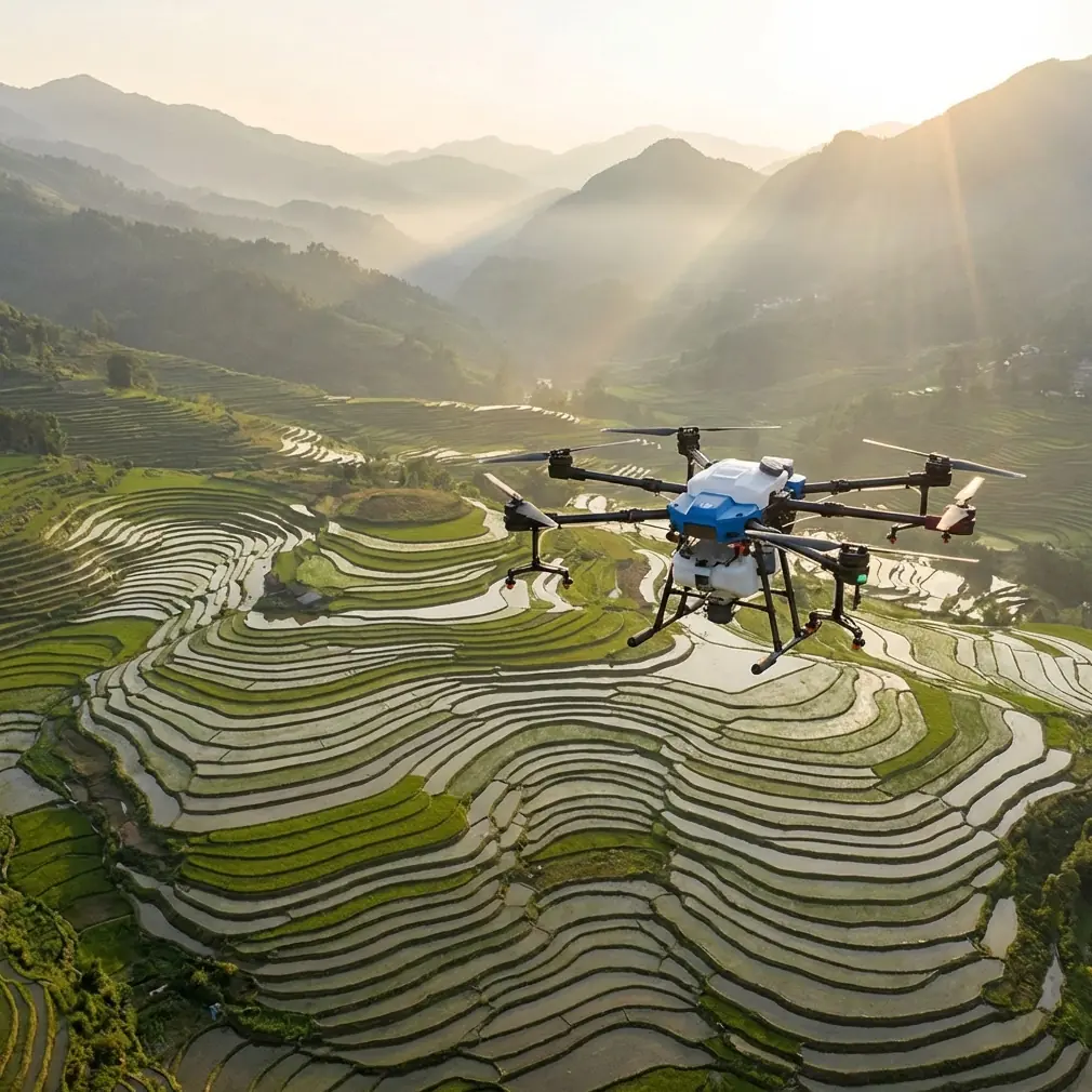
Agras T100 in Dusty Forest Mapping: A Field Report on High-Altitude Stability, Control Discipline, and Signal Resilience
META: Expert field report on using Agras T100-style workflows for dusty forest mapping, with lessons from high-altitude drone testing, RTK reliability, interference handling, and calibration discipline.
Dust changes everything.
It sits on the airframe, softens contrast on sensors, creeps into connectors, and exposes every weak point in a flight workflow. Forest mapping adds another layer: broken canopy, irregular terrain, patchy satellite visibility, and constant pressure to keep lines tight when the aircraft is working near trees and elevation changes. If the mission profile also includes upland terrain, the margin for sloppy setup gets thin fast.
That is why the most useful way to think about the Agras T100 is not as a spec-sheet object, but as an operating platform that either holds together under environmental stress or does not.
A recent high-altitude test campaign in Yunnan offers a practical lens for this. On February 4, at Lanping Fenghua General Airport in Nujiang, multiple UAVs completed successful trial flights in a true plateau environment. The site sits at 2524.8 meters above sea level and is described as Yunnan’s first A1-class high-altitude general aviation airport. That matters for anyone evaluating T100 deployment logic in dusty forest terrain, because altitude and dust tend to reveal the same thing: whether the aircraft ecosystem can maintain stable control, dependable data links, and predictable performance when conditions stop being forgiving.
The Yunnan trials covered 6 aircraft across small, medium, and large categories, including vertical takeoff fixed-wing systems and a large multirotor platform. More useful than the aircraft count, though, were the test items. They included image and data transmission, detection and positioning, maximum takeoff weight, level-flight speed boundaries, hover ceiling, and endurance time, with 11 days of closed testing completed before the public demonstration phase.
For an Agras T100 operator mapping dusty forest blocks, those details are not abstract. They define the same operational questions you face before every serious job:
- Will the link stay clean when the terrain begins to mask line-of-sight?
- Will positioning hold when the environment gets noisy?
- Will the aircraft remain predictable near the edges of its working envelope?
- Can the mission be repeated with the same geometry tomorrow, after the dust and wind pick up?
Why a high-altitude test story matters to a forest mapping workflow
The T100 is often discussed through agricultural language, but many of the habits that make it reliable in field operations carry over to forest mapping support tasks, boundary documentation, vegetation block assessment, and site logistics planning. In dusty forest conditions, your real challenge is not just data capture. It is repeatability.
At 2524.8 meters, thinner air puts pressure on lift efficiency, hover behavior, and energy management. In a forest environment, you may not be flying at that elevation, but you may still be dealing with unstable microclimates, warm air columns over cleared areas, and localized turbulence at the canopy edge. When a drone family proves stable in a high-plateau test regime that includes hover ceiling and endurance evaluation, it gives operators a more grounded basis for judging where the platform can tolerate environmental variation.
The Yunnan program also emphasized image/data transmission and detection/positioning. For T100 users, the operational significance is straightforward: mapping quality starts before the first waypoint. A mission is only as good as its link integrity and positional confidence. If your RTK fix rate is inconsistent under canopy margins or near terrain breaks, your centimeter precision claims collapse into field rework. If your video and telemetry links are noisy, the pilot starts making corrections late, and late corrections are where drift, overlap errors, and missed strips are born.
Dusty forest mapping punishes lazy preflight habits
A lot of avoidable errors begin on the ground.
Dusty forestry work is especially hard on antennas, downward sensors, payload mounts, and any exposed surfaces that support stable navigation. The temptation is to focus on route design and forget the physical condition of the platform. That is backwards. Route logic cannot rescue contaminated sensors or a compromised signal path.
My own rule for a T100 deployment in dusty woodland is simple: if you are seeing intermittent telemetry behavior, don’t start by blaming the terrain model. Start with line basics.
Check antenna orientation first.
That sounds small, but it is one of the most common causes of inconsistent control and data quality in mixed-terrain operations. Electromagnetic interference often presents like a software problem when it is actually a geometry problem. If the aircraft is operating near metal site infrastructure, temporary communications hardware, or even vehicles staged too close to the launch point, small antenna adjustments can materially improve link stability. The fix is rarely dramatic. You rotate, separate, and re-test. Yet that small discipline often restores a healthier control relationship than pilots expect.
If you need a second set of eyes on antenna setup and interference troubleshooting in the field, this WhatsApp line for T100 operational questions is a practical place to start.
Control response still matters, even in semi-automated work
One reference in the source material comes from an aerobatic training discussion rather than a commercial UAV brief, but the lesson transfers cleanly. It explains how airflow disturbance around control surfaces can make response sluggish, especially near centered inputs, and notes that a thicker control surface with a rounded leading edge improved control performance by 50% across varying attitudes and speeds.
No, the Agras T100 is not an aerobatic airplane. But the operating principle is valuable: control authority that remains consistent across changing airflow conditions is not a luxury; it is a safety and quality requirement.
In dusty forest mapping, you often transition through different local air states within a single sortie. Open clearing, canopy edge, narrow access road, and ridge shoulder all create different airflow behavior. If the aircraft’s control logic, stabilization, and mechanical responsiveness are robust, it tracks lines and heading changes with less hunting. That gives you better swath consistency, steadier route adherence, and less downstream correction in your map products.
This is also why pilots should resist the false comfort of “the autopilot will sort it out.” Automation is only as strong as the aircraft’s ability to interpret and execute inputs under imperfect conditions. Good control response shortens the gap between command and movement. In mapping work, that gap is where strip alignment degrades.
What formation-training logic teaches about repeatable drone movement
Another source reference describes a five-drone educational routine: connect 5 aircraft, climb to around 130 centimeters, then have aircraft 2 and 4 rise 25 centimeters while 1, 3, and 5 descend 25 centimeters, creating a wave pattern repeated 5 times.
On the surface, that has nothing to do with an Agras T100 in forestry. In practice, it reveals something central to professional UAV work: reliable operations come from repeatable altitude and positional behavior, not from isolated successful flights.
Why does this matter in a dusty mapping environment? Because forest missions are full of small vertical decisions. Can the aircraft hold a stable relative height as terrain changes? Does it transition cleanly when route segments bring it from open ground toward vegetation walls? Can it repeat that behavior over multiple sorties without accumulating error?
The educational example is simple, but its operational significance is serious. Precision movement is built from disciplined command-response consistency. Whether the vertical step is 25 centimeters in a training room or several meters over uneven forest topography, the principle is identical: you need the aircraft to execute planned changes cleanly and repeatedly.
That is where RTK fix rate and calibration quality become inseparable. If your fix is unstable, your waypoint accuracy degrades. If your nozzle or payload settings are off on a multi-role platform, your balance and dynamic behavior may shift more than expected. That is one reason even mapping-adjacent T100 operations benefit from the agricultural culture of meticulous setup.
Nozzle calibration and spray drift still belong in the conversation
Some readers may wonder why spray drift and nozzle calibration deserve mention in a forest mapping article. The answer is that the Agras T100 is not just a camera carrier in the abstract; it belongs to an operational family where payload behavior, balance, and environmental exposure all affect mission quality.
If the aircraft is moving between spray and mapping support roles, poor nozzle calibration is not just an application problem. It can become a cleanliness, residue, and maintenance problem that affects later sensor work. Drift contamination on surfaces, dust binding to residue, and uneven post-job cleaning all degrade readiness. In a dusty forest setting, that compounds quickly.
Even when the day’s mission is mapping-focused, the right discipline is to treat the aircraft as a precision field tool:
- verify payload configuration,
- confirm balance,
- inspect for residue and dust accumulation,
- validate RTK status before takeoff,
- and confirm that antennas are positioned for the actual terrain, not just the launch pad photo angle.
Operators who skip those steps often assume their issue is software. Most of the time, the aircraft has already told them the truth through setup inconsistency.
Multispectral expectations versus field reality
There is also a tendency to overpromise what mapping outputs will do in forested dust-heavy environments. If you are integrating multispectral workflows, remember that canopy density, particulate haze, and lighting variability can reduce the practical value of clean-looking flight plans. A technically successful mission can still yield weak analytical value if environmental conditions are working against the sensor.
This is where the Yunnan test emphasis on detection and positioning is again useful. Positioning is not the whole mission. It is the foundation that allows all higher-level outputs to mean something. Before debating advanced forest analytics, make sure the aircraft is producing stable path execution, reliable telemetry, and repeatable capture geometry.
That sounds obvious. Yet many teams chase software improvements while ignoring weak field fundamentals.
Swath width is not just an efficiency number
In open farmland, swath width often gets treated like a productivity metric. In dusty forestry work, it should also be treated as a quality control metric. Wider is not always better if your route edges run close to obstacles or if crosswind and turbulence near the canopy are nudging the aircraft off ideal track.
A T100 operator who understands this will adjust expectations. You do not protect map quality by maximizing coverage on paper. You protect it by matching swath assumptions to the environment the aircraft is actually flying through.
The same thinking applies to speed. The Yunnan tests included maximum and minimum level-flight speed demonstrations for a reason. Boundary speed values matter less than the operator’s ability to choose the right working speed for the task. In dusty forest mapping, slightly slower and more stable often beats nominal efficiency, especially when preserving overlap, minimizing blur risk, and reducing correction loads later.
What separates capable operators from merely equipped ones
The strongest takeaway from the source material is not about one single test or textbook lesson. It is about operating discipline under non-ideal conditions.
From the Yunnan high-plateau trial, we get a real-world example of UAV systems being pushed through altitude-sensitive evaluations that included transmission, positioning, weight, speed, hover ceiling, and endurance after 11 days of closed testing. That tells us professional deployment should be evidence-driven, not assumption-driven.
From the training material, we get a compact but sharp reminder that repeatable altitude and positional movement is the basis of coordinated flight behavior.
From the control-surface discussion, we get a deeper aerodynamic truth: when responsiveness stays reliable across changing speed and airflow conditions, the operator’s job gets easier and the output gets better.
Put those together, and the Agras T100 story in dusty forest mapping becomes clearer.
This platform should be judged by how well it preserves control confidence, RTK consistency, and mission repeatability when the environment becomes messy. Dust, uneven terrain, partial signal obstruction, and local interference are not side issues. They are the job.
The operators who get the best results are usually the least theatrical about it. They clean obsessively. They calibrate before they are forced to. They watch RTK behavior instead of assuming it. They treat antenna placement as part of flight planning. They do not confuse a successful takeoff with a validated workflow.
That mindset is worth more than any headline feature.
Ready for your own Agras T100? Contact our team for expert consultation.