
How I’d Approach Forest Spraying With the Agras T100 in Comp
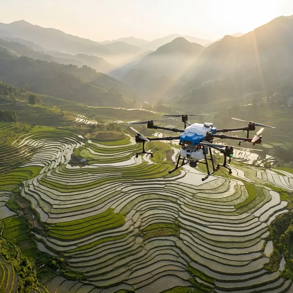
How I’d Approach Forest Spraying With the Agras T100 in Complex Terrain
META: A field-focused tutorial on using the Agras T100 for forest spraying in complex terrain, with practical guidance on drift control, route confidence, impact awareness, and reliable return planning.
Forest spraying looks simple on a brochure map. In the field, it rarely is.
You’re dealing with broken canopy edges, irregular corridors, sudden elevation changes, damp understory airflow, and the constant pressure of getting a loaded aircraft back home safely when visual references begin to collapse into sameness. That’s where the Agras T100 conversation gets interesting. Not because a spec sheet solves forestry work, but because the right aircraft only matters when paired with the right operating logic.
I learned that the hard way on a mountain-edge tree treatment project where the spray task itself was manageable, but the return leg kept becoming the real problem. The treatment blocks were long, narrow, and visually repetitive. Tall stands on both sides made orientation less intuitive than it looked from takeoff. The aircraft could finish the line. The challenge was preserving confidence after the line, when the pilot needed clean positioning, disciplined flight behavior, and a predictable route back through a landscape that did not offer many forgiving cues.
That is the lens I’d use for the Agras T100 in forest spraying: not “Can it spray?” but “Can the whole operation remain controlled when terrain, vegetation, and distance start stacking friction into every decision?”
Start with the part most operators underestimate: the return path
In forestry work, outbound spraying gets the attention. Return planning deserves more.
A useful clue comes from recent research inspired by bee navigation. Researchers developed a drone return method based on how bees orient themselves, using a neural network of only about 3.4 kilobytes. That tiny model lets the drone interpret panoramic environmental imagery, estimate its own movement direction, and even infer the distance back to its starting point.
Why does that matter for an Agras T100 operator in a forest block?
Because forests create one of the most difficult visual environments for long working legs. Repeating textures can make one corridor look like the next. GNSS remains central, of course, and your RTK Fix rate is still a major operational indicator when you’re trying to hold centimeter precision over uneven ground. But the bee-inspired result points to something bigger: robust return behavior in complex terrain does not always depend on brute-force computing. It depends on recognizing the environment in a way that remains stable when the operator is tired, the aircraft is farther out, and the landscape offers fewer obvious references.
For T100 mission planning, that translates into a practical habit: treat the return route as a separate phase, not an afterthought. Before the first tank goes up, I would identify what the aircraft will “see” on the way back. Clearings, stand boundaries, access tracks, drainage cuts, and elevation transitions all matter. Even if your primary navigation stack is satellite-anchored, environment-aware route thinking creates a second layer of operational resilience.
That mindset becomes even more useful in forestry than in flat-field crop work, because a forest edge can visually compress distance. When an aircraft is farther away than you think, small orientation errors become expensive.
Build your spray plan around terrain-driven drift, not just label rate
Forest application is less forgiving than broadacre work because the vegetation itself manipulates airflow.
You cannot think about nozzle calibration in isolation. Nozzle choice, droplet behavior, swath width, flight speed, and canopy interaction all connect. In open fields, a wide swath may still produce acceptable consistency if conditions are stable. In forests, complex terrain means the wind you measured at the launch point is often not the wind acting inside the spray corridor.
That is why I would configure the Agras T100 with a conservative mentality first, then expand only when the deposition pattern proves stable. Start by validating actual swath width under the site’s real airflow conditions, not the number you hope to achieve. If the corridor runs along a slope break or beside taller stands, assume your spray drift risk is higher than the launch area suggests.
This is where experienced operators separate output from performance. A fast mission with poor deposition is not efficient. It is a rework plan that hasn’t happened yet.
For the T100 in forest spraying, my checklist would revolve around these questions:
- Is the swath width still uniform near canopy transitions?
- Does your nozzle calibration hold when flying from open margin into denser stand edge?
- Are you seeing downwash-driven displacement near uneven terrain?
- Is the aircraft maintaining the intended height cleanly enough to preserve droplet behavior across changing elevation?
The answer to all four determines whether your “hectares per hour” mean anything.
Why impact behavior matters more in the woods than many operators admit
Agricultural pilots tend to think first about drift, pump performance, and route efficiency. In forestry, obstacle interaction deserves equal weight.
One training document on small drones offers a useful safety lesson. In testing, a drone flying backward at 50 centimeters per second typically showed X-axis acceleration below 100 and pitch angle around 5 degrees in normal flight. But during a wall strike, acceleration surged to above 2000, and pitch angle could exceed 20 degrees.
Those numbers come from an educational drone context, not a loaded agricultural platform, so I’m not treating them as one-to-one values for the Agras T100. The operational significance lies elsewhere: impact loads and attitude changes spike dramatically the instant controlled flight becomes contact flight.
In forest spraying, that matters because contact events are not limited to obvious collisions. A branch tip, unseen trunk edge, hanging vine mass, or abrupt operator correction near an obstacle can trigger the same chain of problems in principle: sudden acceleration, attitude upset, spray inconsistency, and a recovery sequence that consumes both distance and margin.
This is one reason I do not like aggressive reverse movement in tree corridors unless the route has been thoroughly verified. Backward flight can feel efficient when repositioning, but dense environments punish reduced visibility. The educational findings underline a simple truth: the transition from normal motion to impact is violent and fast.
So with the T100, I’d apply that lesson operationally in three ways:
1. Keep repositioning deliberate
Do not let route corrections become casual. In forestry, “just back it up a little” is often the beginning of avoidable trouble.
2. Use low-speed validation passes
The source material explicitly recommends low-speed collision research for flight safety. In the field equivalent, that means proving your corridor and turn geometry at conservative speed before you trust the route at production pace.
3. Watch aircraft attitude as a warning sign
If pitch behavior begins to look less settled near a particular line, do not assume it is just pilot feel. In forests, disturbed attitude may indicate airflow issues, route compression, obstacle proximity, or over-ambitious maneuvering.
That kind of restraint protects more than the airframe. It also protects deposition quality, because once the aircraft is jolted out of a stable profile, the spray pattern is no longer doing what your plan assumes.
A useful old flight lesson still applies to the T100: when the aircraft is far, choose the maneuver that brings it back cleanly
One of the more interesting references here comes from model aircraft training. It notes that when an aircraft is flying farther away and the goal is to bring it back quickly without losing altitude, the half Cuban eight is a practical turning figure. It also points out that after descending from the 45-degree line, the aircraft recovers speed quickly and ends up a bit closer to the pilot.
Now, an Agras T100 is not an aerobatic model, and nobody should be improvising stunt geometry in a spraying mission. That is not the takeaway. The real value is conceptual.
The lesson is this: when distance becomes a problem, the return should be designed to recover proximity efficiently while preserving control and energy.
For forestry spraying, that means your turnaround logic should avoid lazy, drifting, space-hungry arcs that push the aircraft farther into ambiguous terrain. Instead, use route structures that bring the T100 back toward the operator or the safe corridor in a predictable, altitude-stable way. The best return is not the prettiest line on screen. It is the one that reduces uncertainty fastest.
This is especially relevant on sloped forest margins, where a wide turn can quietly push the aircraft behind visual clutter or into a different wind regime. If the mission geometry lets the drone end each segment slightly closer to a clean visual or positional reference, workload drops. That is real operational value.
My field workflow for the Agras T100 in complex forest blocks
If I were setting up the T100 for this kind of work tomorrow morning, my process would look like this.
1. Break the forest into return-safe sections
Do not map one big heroic block if the terrain does not deserve it. Divide the job by visual references, access lanes, and topographic logic. Every section should have an obvious route home.
2. Validate RTK behavior before you care about output
A healthy RTK Fix rate is not just a positioning metric. In forestry, it supports repeatable height control, cleaner line spacing, and less cumulative correction. If the fix quality is unstable, everything downstream gets weaker, including swath consistency and turn precision.
3. Confirm nozzle calibration on the actual site
Not beside the truck. Not in an open patch that behaves differently from the treatment zone. In the actual airflow environment. Forest edges create false confidence if calibration is done in cleaner air than the spray line will experience.
4. Reduce swath assumptions until deposition proves itself
A narrower effective swath that lands properly is more productive than a wider one that drifts or skips. Especially near mixed-height stands.
5. Use conservative speed through uncertain corridors
The educational impact data makes the point clearly enough: when things go wrong, they go wrong abruptly. Slower validation passes buy time, preserve margin, and often reveal route flaws before they become hard contact.
6. Protect the machine from the environment, not just the weather
Forestry work is dirty work. Moisture, residue, and splashback matter. For operators evaluating durability in these conditions, features associated with IPX6K-level protection are worth attention because cleaning and wet-environment exposure are not occasional events in spray operations. They’re part of the job rhythm.
7. Keep a second-layer observation habit
Even with good positioning, I want the operator watching environmental cues: canopy openings, track intersections, shadows, and edge contrast. The bee-navigation research is a reminder that visual context is not a luxury. It is part of reliable return logic.
If you’re planning a real forest application workflow and want to compare route logic or spray block structure, you can send your scenario here: message Marcus directly on WhatsApp.
Where the Agras T100 fits best
The Agras T100 makes the most sense in forest spraying when the operator values control discipline as much as payload productivity.
Complex terrain does not reward optimism. It rewards systems thinking.
A capable spray platform in the woods must do several things well at once:
- hold precision over changing elevation,
- maintain a dependable spray profile,
- avoid compounding drift at canopy edges,
- and return home with less drama than the landscape invites.
The reference material behind this article points in the same direction from three different angles.
The bee-inspired navigation work shows that successful return can come from smart interpretation of surroundings, not just raw data volume. That matters in visually repetitive forest environments where losing route confidence is easy.
The educational collision data shows how sharply acceleration and pitch can jump during impact events, which is a strong reminder that dense terrain punishes sloppy repositioning and casual reverse movement.
The flight training material reinforces a timeless operational principle: when the aircraft gets far out, your turn strategy should bring it back efficiently without sacrificing control.
Put together, those are not random facts. They form a practical forestry doctrine for the T100:
Spray with restraint. Calibrate for the environment you actually have. Respect return geometry. Keep the aircraft closer to certainty than to theoretical efficiency.
That is how hard forest blocks become manageable. Not easy. Manageable.
And in this segment of UAV work, that difference is everything.
Ready for your own Agras T100? Contact our team for expert consultation.