
Agras T100 in Dusty Field Survey Work: A Consultant’s Case
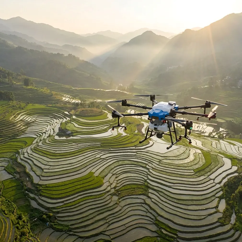
Agras T100 in Dusty Field Survey Work: A Consultant’s Case Study on Precision, Discipline, and Better Capture
META: A field-based case study on using Agras T100 for dusty agricultural surveying, with practical insight on flight precision, operator technique, and capturing usable slow-motion footage for analysis.
Dust changes everything.
It gets into hinges, coats lenses, softens contrast, hides crop stress, and punishes loose operating habits. When growers ask me about using an Agras T100 around dry paddocks, wind-frayed field edges, and powdery headlands, they usually expect a conversation about payload, coverage, or workflow speed. Those matter. But in real field conditions, the bigger story is control: how precisely the aircraft moves, how consistently the operator thinks, and how clearly the team documents what actually happened.
That was the center of one recent consulting job. The client wanted cleaner survey passes across a dry farm block where visibility near the surface was regularly affected by dust kicked up from vehicles, irrigation maintenance, and bare soil strips between active crop rows. They were also trying to reduce uncertainty around spray drift exposure zones and improve how they reviewed nozzle behavior after flights. The platform under discussion was the Agras T100, but the real lesson had less to do with spec-sheet theater and more to do with disciplined use.
The problem wasn’t only dust. It was ambiguity.
On paper, a field survey sounds straightforward. Launch, map, inspect, log findings, move to the next block. In dusty conditions, though, small mistakes stack up. A pilot overcorrects on line entry. The aircraft rises or slides more than intended. Dust plumes distort visual reference. A pass that seemed clean in the moment looks sloppy on review. Then the agronomy team starts second-guessing whether a weak patch came from crop stress, drift, clogged nozzles, or just poor observational data.
For this farm, the owner’s concern started with edge variability. Several boundary zones were showing inconsistent crop response, and there was worry about overlap behavior and drift near open margins. They didn’t need vague reassurance. They needed a repeatable method.
That is where one educational reference, oddly enough, becomes operationally useful even for a serious commercial platform like the Agras T100. A training document on drone coordinate flight describes movement in three-dimensional space using x, y, and z values for forward-back, left-right, and up-down travel. It gives a concrete example of a flight target written as (50,60,80) from a starting point of (0,0,0). On the surface, that sounds elementary. In practice, it’s the mindset behind reliable field work.
When I train teams, I often strip away brand language and go back to coordinate thinking. If the aircraft must move to a known point in space, every correction has a consequence. In a dusty field, this matters because your visual cues are degraded. You may think you’re making a tiny lateral adjustment, but in poor visibility that movement can widen uncertainty across swath edges, photo alignment, or inspection consistency. Centimeter precision only pays off when the operator respects the geometry of the mission.
Why coordinate discipline matters on an Agras T100
The Agras T100 is the kind of machine people expect to behave confidently in hard agricultural environments. That expectation is fair, but confidence in the aircraft should never replace precision in the workflow. Dusty surveying puts pressure on RTK fix rate, route repeatability, and the operator’s ability to distinguish actual crop anomalies from artifacts caused by movement, angle, or visibility.
The educational material I mentioned also recommends a control-variable approach: change one coordinate value first, then study the effect before changing multiple values together. That is smart advice well beyond the classroom. In field operations, if you’re troubleshooting edge drift, uneven overlap, or uncertain capture angles, changing one parameter at a time is how you avoid fooling yourself.
For example:
- If line tracking appears inconsistent near a dusty boundary, don’t simultaneously adjust altitude, speed, and route spacing.
- If nozzle calibration review suggests asymmetry, don’t blame hardware before checking whether aircraft positioning, wind angle, and pass alignment were stable.
- If multispectral or visual findings seem inconsistent, isolate whether the issue came from light, movement, dust, or camera angle.
That method is boring. It is also how professionals get repeatable results.
The wildlife moment that proved the sensors were doing real work
Mid-mission, a ring-necked pheasant burst from a weedy ditch along the south perimeter. It cut across the route lower and faster than anyone expected, right where dust had already reduced surface contrast. The reason that moment stuck with the team wasn’t drama. It was validation. The aircraft handled the interruption cleanly enough that the operator could maintain composure rather than compound the event with a rushed correction.
That matters in agriculture because unexpected movement is normal. Birds, dogs, utility crews, vehicles, and irrigation staff all show up where they shouldn’t. In dusty conditions, sensor confidence and measured operator response are part of the same safety chain. You don’t judge a field platform only by what it does in perfect air over a demo plot. You judge it by how well the operation holds together when the environment gets messy.
A second lesson came from an unlikely source: aerobatic training
One of the references in the source set comes from model aircraft training, specifically about establishing a 45° climb line. That document makes two points that are surprisingly relevant to Agras T100 operations, even though the mission profile is entirely different.
First, most pilots underestimate what a true 45° climb looks like. Second, control input must be quick but smooth—never abrupt. The text warns that pulling too hard causes the aircraft to fight inertia and can introduce unwanted wing rocking or deviation.
Now translate that to agricultural drone work.
No, you are not flying aerobatics with an Agras T100. But the human factors are similar. In dusty survey conditions, operators often react too aggressively when visual reference degrades. They jab the controls. They climb too abruptly over a tree line or ditch edge. They make a rushed correction after seeing a dust plume or obstacle movement. The result is not “faster recovery.” The result is degraded line quality, unstable camera perspective, poorer evidence for drift review, and occasionally worse spray consistency on adjacent work.
That training source is right about something many drone teams learn late: smooth control is not soft control. It is disciplined control. The best operators are decisive without being violent on the sticks.
I watched this play out on the client’s second block. One pilot kept trying to “snap” the aircraft into alignment after each dusty turn. Another pilot flew the same segment with less drama, entering and exiting the line with a calmer rate of change. The second dataset was easier to interpret. Edge conditions looked cleaner. Dust signatures were less misleading. The agronomist trusted the results more.
Slow-motion video became a technical tool, not just nice-looking content
Most farms now understand the value of documenting drone operations, but they often overcomplicate it. Another source in the material set points out something refreshingly practical: a phone’s built-in camera can shoot slow-motion footage without props or editing. On iPhone, you open the camera and swipe to Slo-mo. On Android, you go to the video section and select Slow Motion/Slow-mo.
That sounds almost too basic to mention in an article about the Agras T100. It isn’t.
We used exactly that approach at the farm. One team member stood at a safe observation point and recorded short slow-motion clips of takeoff dust behavior, line entry, and visible nozzle output patterns. No external rig. No post-production circus. Just native phone slow-mo.
Why was this useful?
Because dusty field problems happen fast. A normal-speed clip may not clearly show when a dust plume begins to interfere with visibility, whether a pilot’s correction was smooth or abrupt, or how the spray pattern behaved during entry and exit transitions. Slow-motion footage lets you review:
- whether dust is being kicked up more on one approach path than another,
- whether nozzle calibration needs checking because pattern symmetry looks uneven,
- whether route height and transition technique are contributing to unnecessary disturbance near the canopy,
- whether visible drift risk increases at specific edge zones.
For operators trying to improve procedure rather than just collect pretty footage, this is one of the cheapest high-value habits available. If your team needs a simple field checklist for documenting these events, I usually tell them to send the situation details and sample clips through our field workflow chat so the review stays tied to the mission conditions rather than memory.
Spray drift and dusty surveying are connected more than many teams realize
Dust is not spray drift, but the two often intersect in decision-making. Dust reveals airflow behavior. It exposes how ground effect, speed, and route geometry interact near the surface. When teams ignore that information, they miss a chance to tighten operational discipline.
On this project, the T100 workflow review led to three practical changes.
1. We treated dust as a visible airflow indicator
Instead of seeing every dust plume as a nuisance, we used it as feedback. If one headland approach consistently created more disturbance, that approach needed review. Maybe altitude was slightly low. Maybe the entry angle was too aggressive. Maybe speed changes were poorly timed.
2. We checked nozzle calibration against observed behavior
When spray teams suspect inconsistency, they often jump straight to hardware assumptions. Sometimes that’s justified. But if route stability is weak, you can mistake aircraft movement effects for nozzle problems. Slow-motion review helped separate those issues.
3. We tightened line repeatability expectations
This is where RTK fix rate and centimeter precision stop being marketing terms and become operational tools. Precision isn’t merely about arriving near the right place. It’s about making sure successive passes, inspections, and reviews are comparable enough to support decisions. In a dusty environment, every repeatable element reduces uncertainty.
The hidden value of “training logic” on a professional aircraft
There is a tendency in commercial drone operations to dismiss educational or hobbyist training concepts as beneath serious field work. That is a mistake.
The coordinate-flight reference shows the value of thinking in structured spatial increments. The aerobatic training reference shows how pilots misjudge angles and overcontrol under pressure. The phone slow-motion reference shows that simple documentation can outperform complicated setups when speed matters.
Put those together, and you get a surprisingly effective framework for Agras T100 field surveying:
- Think spatially, not vaguely.
- Change one variable at a time.
- Respect how quickly abrupt inputs can degrade outcomes.
- Record evidence in a form the team can actually review the same day.
That is the kind of system that survives dust, fatigue, and real farm pressure.
What this means for Agras T100 operators working dry ground
If your operation involves dusty paddocks, bare-soil transitions, or field edges where visibility and drift concerns overlap, the Agras T100 should be approached as part of a discipline stack, not as a standalone answer.
The aircraft can support high-precision work. But the results depend on whether the team does four things well:
Build routes around known spatial logic.
Treat movement in x, y, and z terms, not just “a bit left” or “slightly higher.” That mindset prevents messy, subjective corrections.Protect RTK-driven consistency.
A strong fix rate is wasted if operators improvise route behavior every pass. Precision needs repeatability to be valuable.Watch for overcontrol.
The 45° training concept is a reminder that humans regularly misread angle and motion. If a correction feels dramatic, it usually looks worse in the data.Use simple visual review tools.
Native slow-motion phone footage can reveal route-entry dust, nozzle behavior, and transition errors that are hard to catch live.
The farm in this case did not need a miracle. It needed cleaner evidence, steadier operation, and better habits around what the aircraft was already capable of doing. Once those pieces clicked, the Agras T100 stopped being a machine they were “trying out” and became a system they could trust.
That is the shift that matters in professional agriculture. Not excitement. Reliability.
Ready for your own Agras T100? Contact our team for expert consultation.