
Agras T100 for Solar Farm Surveying in Extreme Heat and Wind
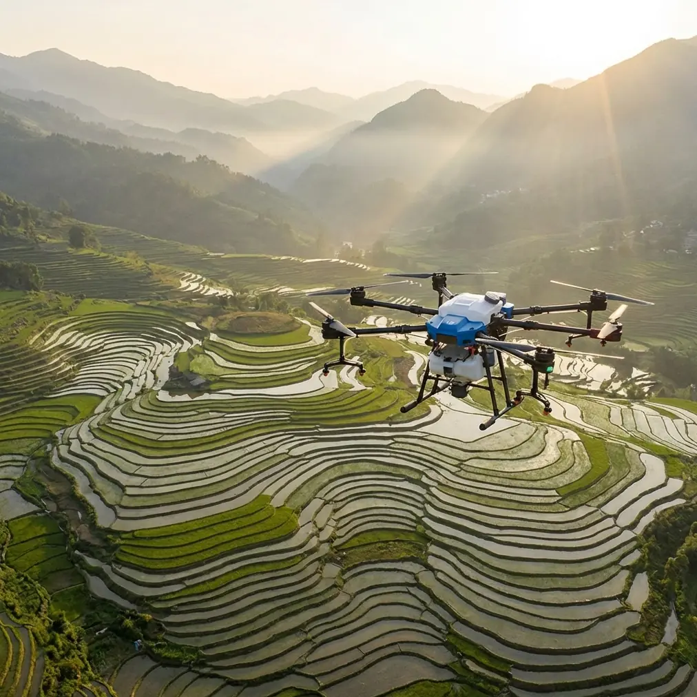
Agras T100 for Solar Farm Surveying in Extreme Heat and Wind: A Field Consultant’s How-To
META: Practical expert guide to using the Agras T100 around solar farms in extreme temperatures, with advice on antenna positioning, RTK discipline, drift control, obstacle sensing, and endurance planning.
Solar farm surveying sounds simple until the site starts fighting back.
By mid-morning, panel glare washes out visual cues. Heat shimmer bends your sense of distance. Afternoon wind kicks dust across access lanes and creates uneven turbulence above row after row of modules. Then there’s the scale. A utility site can punish weak endurance, sloppy route planning, and any aircraft setup that depends on ideal conditions.
That is exactly why the Agras T100 deserves a more serious conversation than the usual platform summary. If your job is to inspect, document, and repeatedly traverse large photovoltaic sites in extreme temperatures, the aircraft’s value is not just lift or automation. It is how well the whole system holds together when range, precision, and mission continuity matter at the same time.
I approach this as a consultant, not a brochure writer. So this guide is built around operational choices: how to set up the T100 for reliable solar farm work, how to think about endurance in real field terms, and how small details like antenna orientation and obstacle sensing can have outsized consequences.
Start with the real constraint: time over the site
The most useful recent signal in the broader UAV market did not come from a marketing deck. It came from a hydrogen power seminar held on January 16 in Shenzhen, where a hydrogen-powered drone flew continuously for 4 hours before landing safely at the end of the event. That demonstration matters because it publicly highlighted what serious operators have been saying for years: the next bottleneck is no longer just whether a drone can fly, but how long it can remain productive without interrupting the mission.
The same seminar brought together companies across the low-altitude aviation chain, and participants specifically emphasized the need for long endurance and high-payload power. That demand maps directly to solar farm operations. On a large site, every forced pause has a cost. You stop. You swap. You recheck coverage. You verify data continuity. You lose the cool morning window and drift into harsher thermal conditions.
Why mention a hydrogen endurance demo in an article about the Agras T100? Because it clarifies the benchmark. Even when you are not flying a hydrogen platform, you should manage the T100 with an endurance-first mindset. The goal is to reduce wasted transit, cut unnecessary re-flights, and make each launch cover a coherent block of work. Operators who think this way get more useful survey output from the same airframe.
Define the mission correctly: survey discipline, not agricultural habit
The T100 sits in an agriculture-first category, so many crews instinctively frame its work around spraying patterns and treatment routines. That is a mistake on a solar site.
Surveying requires a different hierarchy:
- positional integrity
- repeatable route execution
- line-of-sight signal stability
- obstacle awareness around structures
- clean data management under harsh environmental stress
The LSI terms people chase online—RTK fix rate, centimeter precision, swath width, nozzle calibration, spray drift, multispectral, IPX6K—are only useful if they are put in context.
For solar farm surveying, the first two to care about are RTK fix discipline and route geometry. If your fix quality drops intermittently, your repeatability suffers. If your path lines are lazy or too ambitious, the site’s long metallic rows and service roads magnify small inconsistencies into coverage gaps.
Centimeter-level positioning is not a vanity metric here. It is what lets you revisit the same strings, inverter corridors, fence lines, or drainage edges and compare conditions over time. On a solar farm, trends matter more than a one-off view. You are often trying to answer whether something has shifted, encroached, overheated, settled, or degraded.
Antenna positioning: the overlooked range multiplier
You asked for antenna positioning advice, and this is one of the most practical upgrades you can make without changing hardware.
On broad solar fields, the aircraft usually has fewer vertical obstacles than in urban work. That sounds easy, but it creates a different problem: operators get careless and assume the link will take care of itself. Then they stand too low beside vehicles, shelters, or steel equipment housings, or they point the controller antennas poorly while tracking a drone flying low over reflective panel arrays.
Here is the field rule I give crews:
Keep the controller high, clear, and broadside to the aircraft’s path—not jabbed directly at it.
Why? Because with most controller antenna designs, the strongest pattern is not off the tip. It is off the face or side plane. If you aim the antenna ends at the drone, you can reduce effective link quality. On long transects across a solar block, that can show up as avoidable signal fluctuation right when the aircraft is farthest out.
A few habits help immediately:
- Stand on the highest safe point available along the block edge.
- Avoid placing yourself directly behind maintenance containers, trucks, or combiner cabinets.
- Keep your body from shadowing the controller.
- When flying parallel passes, rotate your torso smoothly so the controller maintains its strongest orientation to the aircraft.
- If the site has rolling terrain, move launch position to preserve line of sight across the lowest point of the route, not just the starting point.
This matters for more than command range. Better link stability supports better route execution and fewer interruptions. That in turn protects data consistency across the survey.
If your team wants a quick field checklist for controller stance and antenna geometry, I usually share it before deployment through this direct setup channel: https://wa.me/85255379740
Extreme temperatures change everything, even before takeoff
The solar environment is not just “hot.” It is layered heat.
Ambient temperature may be moderate at sunrise, but radiant loading from dark panel surfaces rises quickly. Air directly above rows behaves differently than air over dirt or gravel lanes. That creates localized instability which can nudge a heavily tasked aircraft off the clean path it held earlier in the morning.
So with the Agras T100, you should front-load the site.
Fly your most precision-dependent blocks first. Save easier perimeter runs, access road checks, or lower-value repetitions for later. If you’re comparing data across days, launch at roughly the same time window whenever possible. Consistency in environmental conditions often helps your dataset more than squeezing in one extra sortie at noon.
Extreme temperatures also affect human performance. Survey quality often degrades because the pilot gets less disciplined, not because the aircraft suddenly becomes incapable. Checklist drift is real in heat. That is why I like borrowing one lesson from educational drone competition structures: formal restart control.
In one training reference, competitors are allowed to retry within a 2-minute competition period, but only after judge approval, with scoring penalties and a defined restart process. The deeper lesson is not about competition. It is about procedural discipline. If you abort a T100 solar survey leg for telemetry concerns, route mismatch, or site intrusion, do not casually “pick it back up.” Re-establish launch logic, verify the route segment, and restart cleanly. Partial improvisation is how survey gaps and duplicate coverage creep in.
Obstacle sensing is more relevant on solar farms than many crews expect
At first glance, solar farms look open. In practice, they are full of repetitive hazards:
- array rows with changing elevation
- tracker structures
- perimeter fencing
- cable bridges
- weather stations
- CCTV poles
- substations and inverter pads
- temporary maintenance equipment
That is where TOF-style obstacle awareness becomes conceptually useful. A drone education reference specifically highlights learning to use a TOF obstacle avoidance module to detect maze walls and complete exploration tasks. Strip away the classroom framing and the operational point is sharp: proximity sensing is most valuable in environments where repetitive structures can lull the pilot into underestimating collision risk.
A solar farm is basically a giant, low-altitude maze with better branding.
When you are surveying close to rows or making cross-lane transitions, use obstacle systems as part of your risk envelope, not as permission to fly sloppily. Sensors help detect structure boundaries, but they cannot replace route design. Build lane spacing and turning margins that respect the site’s geometry, especially where terrain undulates or tracker angles vary.
If you’re also using spray hardware, drift control still matters near panels
Some T100 deployments touch both survey and application work on mixed-use sites or nearby vegetation management programs. If your mission stack includes spraying around solar infrastructure, spray drift and nozzle calibration become more than agronomic buzzwords.
Drift around panels can create contamination issues, uneven deposition, or maintenance headaches. Nozzle calibration matters because the same row geometry that helps a route stay orderly can also channel airflow in unpredictable ways. A flat, open approach to calibration rarely reflects what actually happens between tightly spaced arrays and service corridors.
Even if the day’s primary task is survey, keep a separate profile for application work and do not assume one setup transfers cleanly to the other. Survey precision and spray accuracy are cousins, not twins.
Motor and ESC behavior matters more in punishing environments
One of the quieter technical references in your source set comes from the BLHeli manual. It notes support for multiple PWM input rates—1kHz, 2kHz, 4kHz, 8kHz, and 12kHz—along with automatic input detection at power-up, sync-loss prevention, tuneable parameters for different motors, and a beacon function that begins beeping after a period of zero throttle.
You do not need to retrofit the T100 around hobby ESC theory to learn from this. The significance is operational: multirotor reliability depends on motor-control stability and fault tolerance, especially where environmental stress exposes weak tuning or inconsistent startup behavior.
Three lessons carry over nicely to field practice:
1. Respect startup consistency
Any power-up irregularity deserves attention before you launch into a long block over reflective infrastructure. Systems that auto-detect signal conditions still depend on clean initialization. Do not normalize odd spool-up feel or asymmetric sound.
2. Heat exposes marginal tuning
The BLHeli note about parameters that can be tuned to work with almost any motor is a reminder that propulsion stability is never abstract. On extreme-temperature solar sites, any drivetrain weakness gets easier to trigger. Watch for vibration, transient oscillation, and temperature-linked performance changes.
3. Recovery tools save time
The beacon function in the manual exists because finding an aircraft after an off-nominal event can waste precious time. On solar farms, where rows can visually hide a grounded drone from certain angles, audible or trackable recovery logic matters. Even if your T100 platform handles this differently, the principle stands: build your survey SOP around fast aircraft location after interruption.
Route planning: think in blocks, not in battery cycles
One of the worst habits I see is planning the mission around how many flights the crew expects to get through, rather than around coherent survey blocks.
Do it the other way.
Break the site into meaningful operational zones:
- south field tracker rows
- inverter pad corridors
- drainage perimeter
- fence and access edge
- maintenance staging area
- anomaly recheck loops
Then assign each launch a clear block. That gives you cleaner logs, more reliable re-fly planning, and fewer “where exactly did we stop?” conversations in the truck.
This is where the endurance conversation returns. The Shenzhen hydrogen drone’s 4-hour continuous flight was not just a publicity number. It underscored the industry’s push toward fewer interruptions and more complete task windows. Until platforms like the T100 inherit that kind of endurance profile, crews should compensate with smarter mission architecture.
A practical T100 survey workflow for harsh solar sites
Here is the stripped-down sequence I recommend:
Pre-sunrise to early morning
- Walk the launch area and identify the highest, clearest controller position.
- Confirm antenna orientation before takeoff.
- Check RTK status and do not rush into the first leg with marginal fix quality.
- Fly the most alignment-sensitive survey blocks first.
Mid-morning
- Reassess wind by row section, not just at launch point.
- Watch for signal behavior changes as thermal activity builds over panel fields.
- Keep line turns conservative near poles, tracker edges, and fenced equipment zones.
Noon and later
- Shift to less precision-critical blocks if heat shimmer intensifies.
- Increase pilot hydration and shorten decision loops.
- Abort early if route quality starts degrading. Clean restarts beat compromised continuity.
End of day
- Mark any partial blocks immediately.
- Log where environmental factors changed output quality.
- Review whether controller placement or antenna handling contributed to any link issue.
The bigger picture for Agras T100 users
The most interesting story around the T100 right now is not a single feature. It is the convergence of three operational realities.
First, the wider UAV industry is clearly pushing toward longer endurance and higher payload capability, as seen in the recent Shenzhen hydrogen systems seminar and the 4-hour flight demonstration. Second, precision work still depends on disciplined route control and obstacle awareness, something reinforced even by simple training materials that emphasize TOF-based navigation and structured restart procedures. Third, propulsion and signal reliability remain foundational, which is why even a dry ESC manual offers practical lessons about startup detection, sync stability, and recovery logic.
Put together, that means the best T100 operators will not be the ones who merely launch faster. They will be the ones who run the platform like a repeatable field system.
On a solar farm in extreme temperatures, that difference shows up quickly. Better antenna positioning extends useful control confidence. Better block planning reduces wasted sorties. Better restart discipline protects the dataset. Better respect for heat and turbulence preserves route accuracy.
That is what expert surveying actually looks like. Not glamour. Not generic autonomy talk. Just deliberate execution under conditions that expose shortcuts.
Ready for your own Agras T100? Contact our team for expert consultation.