
Agras T100 in Mountain Wildlife Survey Work
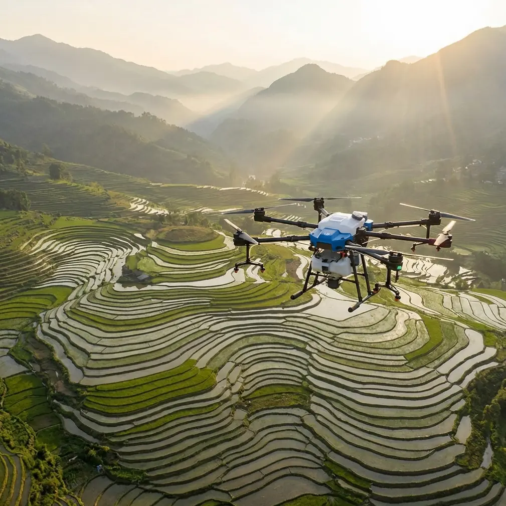
Agras T100 in Mountain Wildlife Survey Work: A Field Case Study on Precision, Training Logic, and Antenna Setup
META: A practical case study on using Agras T100 workflows for mountain wildlife survey missions, with guidance on centimeter-level positioning logic, RTK stability, antenna placement, flight pattern design, and training methods.
Most people looking at the Agras T100 think first about agricultural throughput. In mountain wildlife survey work, that instinct can actually get in the way.
Terrain breaks line of sight. Vegetation interrupts signal paths. Launch areas are often improvised. The operator is rarely dealing with a neat rectangular block of land; instead, they are working around ridgelines, tree clusters, ravines, and sensitive habitat where repeatability matters more than brute-force coverage. In that setting, the smartest way to use an Agras T100 is not to treat it like a simple “big drone.” You treat it like a platform that must be trained, referenced, and flown within a disciplined coordinate logic.
That distinction became clear in one of our recent mountain survey planning exercises. The objective was civilian and conservation-focused: repeated wildlife observation runs over a broken upland area where the team needed consistent path geometry, stable positioning, and predictable aircraft behavior from one sortie to the next. The useful lesson was not just about hardware. It was about workflow design.
Why mountain wildlife survey work demands a different mindset
A mountain survey mission usually has three constraints at once.
First, you need repeatable paths so data from separate flights can be compared over time. Second, you need enough positional confidence to bring the aircraft back into the same spatial relationship with terrain features, especially if you are monitoring movement corridors or habitat edges. Third, you need a training method that reduces pilot workload before complexity is added.
That last point is often underestimated. One of the reference materials behind this article comes from aerobatic flight instruction, and although it was written for a different class of aircraft, the underlying teaching logic is highly relevant here: separate the essential elements needed to complete a maneuver from the finer points that can be polished later. In plain terms, do not chase perfection before you can reliably execute the mission.
For an Agras T100 operator in the mountains, that means building competence in layers:
- stable positioning first,
- repeatable track shapes next,
- sensor consistency after that,
- and only then fine-tuning timing, spacing, and route elegance.
That approach accelerates field readiness. It also reduces the kind of avoidable errors that show up when teams try to master complex terrain flights all at once.
The hidden value of coordinate thinking
One of the most useful ideas in the reference material comes from a training drone challenge-card system. On paper, it sounds simple: each card creates its own coordinate frame, the origin sits at the center of the card, the card plane defines x and y, and the z axis rises vertically. The cards can be placed independently, and their coordinate systems do not interfere with one another.
For mountain wildlife survey work, that concept translates surprisingly well to the Agras T100.
You may not be flying over classroom challenge cards, but the operational significance is the same: break a difficult environment into local reference zones. Instead of thinking of a whole mountain face as one abstract mission area, define individual working cells around landmarks, ridge breaks, or observation targets. Each cell gets its own internal logic for heading, altitude relationship, and track pattern.
That matters because mountains distort pilot intuition. A line that looks straight from the launch point may not be spatially consistent relative to the slope. A turn that feels symmetrical may place the aircraft in different visual and signal conditions on each side of the maneuver. Local reference framing helps restore discipline.
The training source also describes how orientation indicators define positive x direction, while visual recognition patterns identify the reference object and allow the aircraft to resolve position within that frame. Operationally, the Agras T100 crew should borrow that logic by making heading conventions explicit before takeoff. In field practice, that means choosing a single directional reference for each survey cell—often aligned with a ridge, drainage line, or access corridor—so every pass, turn, and revisit follows the same directional grammar.
That is how you get closer to centimeter precision in actual work, not by talking about precision in the abstract, but by making every mission leg refer back to an intentional frame.
Flight shapes are not academic drills
The same training material includes several very specific path forms: a vertical circular route with a radius of 100 centimeters flown for 5 loops, a figure-eight route, and a spiral climb with a 100-centimeter radius flown for 3 loops. Those numbers come from an educational platform, not a mountain utility mission, but the shapes themselves are operationally meaningful.
Why?
Because these path types expose how a pilot and aircraft handle orientation changes, altitude transitions, and continuous curvature. In mountain wildlife survey work, those are exactly the stress points.
A figure-eight is especially useful as a training concept because it forces the operator to manage mirrored turns and a center crossover in a controlled pattern. If a team cannot hold symmetry in a simple figure-eight training sequence, they will struggle to maintain consistency when contour-following around trees, rock outcrops, or uneven thermal conditions.
A spiral climb matters for another reason. In mountainous areas, gaining altitude while staying inside a confined horizontal footprint is often safer and more data-consistent than making a long drifting climb over broken terrain. Even if your operational pattern is larger than the 100-centimeter educational drill, the principle scales: train vertical transitions separately so they become automatic.
That connects directly with the second reference source’s core idea that the more skills become procedural and automatic early, the more mental capacity remains for refinement later. On an Agras T100 mission, that extra mental capacity is what lets the operator monitor environmental cues, confirm RTK fix behavior, watch swath consistency, and maintain safe separation from terrain and canopy.
RTK fix rate matters more in the mountains than on flat ground
The context notes mention RTK fix rate and centimeter precision, and these are not decorative specifications in wildlife survey work. In mountains, they are part of whether your survey can be trusted across repeat visits.
A weak positioning workflow can still look acceptable during a single flight. The problem appears later, when two survey datasets are compared and the aircraft did not actually occupy the same corridor, altitude relationship, or turn geometry. On flat farmland, small deviations may be tolerable depending on the objective. On a mountain wildlife route along a narrow habitat edge, those same deviations can distort interpretation.
For that reason, crews using the Agras T100 in this role should treat RTK stability as a mission gate, not a nice-to-have. If fix quality is inconsistent, route repeatability suffers. If route repeatability suffers, biological observations become harder to compare. That has downstream effects on habitat mapping, movement pattern monitoring, and change detection.
This is also where antenna positioning becomes practical rather than theoretical.
Antenna positioning advice for maximum range
If you want the best possible control and data link reliability in mountain terrain, start with geometry, not settings menus.
Place the ground antenna or controller position where it preserves the cleanest possible line of sight to the expected working volume, not merely to the takeoff point. Those are often different places. A launch spot tucked behind a rock shoulder may feel convenient, but once the aircraft drops behind a tree band or traverses a side slope, your link quality can degrade quickly.
A few habits help:
- Set up on a small rise or open shoulder rather than in a depression.
- Avoid placing yourself directly below a ridgeline that blocks the aircraft’s lateral work area.
- Keep the antenna orientation consistent with the aircraft’s operating sector instead of sweeping it constantly.
- Stay clear of vehicles, metal structures, and improvised camps that can clutter the immediate RF environment.
- If possible, choose a pilot position that maintains visibility not just to the near passes, but to the most signal-challenged turn points.
The reason this matters in wildlife survey work is simple. When the aircraft reaches the edge of a route near canopy, slope, and rock simultaneously, that is the worst time to discover the control position was chosen for convenience rather than propagation. Maximum range in the mountains is really maximum usable geometry.
If your team wants to compare setup notes for difficult terrain missions, I usually tell crews to message me here for field workflow questions and include a sketch of the launch point, ridge direction, and likely dead zones.
Swath width, spray drift, and nozzle calibration still matter—even in survey-adjacent work
At first glance, spray drift and nozzle calibration seem unrelated to wildlife survey work. They are not, especially when the Agras T100 is being evaluated for dual-role use or habitat management missions where survey and treatment planning intersect.
Swath width discipline teaches crews to think in measurable lateral spacing rather than visual guesswork. That mindset transfers directly to corridor-based wildlife observation. If your pass spacing is inconsistent, your coverage density changes from one run to another. In a survey environment, that inconsistency can masquerade as ecological change.
Nozzle calibration enters the conversation because calibrated output is really a lesson in system verification. A crew that checks delivery uniformity, boom behavior, and drift risk is usually a crew that also verifies altitude, route spacing, and overlap logic before collecting habitat data. The technical habits are connected.
Spray drift itself is also relevant as an environmental caution. In mountain conditions, cross-slope winds, rotor wash interaction with canopy edges, and thermal movement can all influence aircraft behavior and any payload-related operation. Even if the day’s mission is strictly observational, the operator who has learned to read drift risk is often better at reading the local air mass. That improves route stability.
Building a better training progression for the Agras T100
The strongest idea borrowed from the second reference is the rejection of premature perfectionism. That principle deserves a direct translation into Agras T100 operations.
A practical training ladder for mountain wildlife survey work looks like this:
Phase 1: Basic completion
Can the operator hold stable flight in a defined local reference area? Can they complete a simple route shape without overcorrecting? Can they maintain heading discipline relative to terrain?
Phase 2: Pattern automation
Can they repeat the same route structure until turns, altitude holds, and recoveries become automatic? This is where figure-eight style drills and circular hold patterns earn their place.
Phase 3: Terrain adaptation
Can they preserve route intent when the slope, canopy height, or line of sight changes? This is where mountain work begins to separate experienced crews from casual operators.
Phase 4: Mission refinement
Only after the first three phases should teams focus on polishing overlap, timing, smoothness, and advanced data consistency.
This progression mirrors the training logic from the reference text: first secure the factors necessary to complete the task, then refine. It sounds obvious, but in the field it prevents wasted time and protects aircraft.
What the Agras T100 operator should take away
The main lesson is not that a classroom drone exercise and an aerobatic teaching manual somehow replace mission planning. They do not. The lesson is that both sources point toward a disciplined truth: precise flight starts with a reliable frame of reference, and reliable performance grows faster when training isolates fundamentals before polish.
For the Agras T100 in mountain wildlife survey work, that means:
- define local reference zones instead of thinking only in global mission blocks,
- maintain strict heading logic relative to terrain,
- train repeatable route shapes before adding mission complexity,
- treat RTK fix quality as a prerequisite for trustworthy revisit data,
- and choose antenna position based on line of sight to the working volume, not simple convenience.
The educational source’s detail that there are 4 challenge cards with 8 total patterns is more than a classroom curiosity. It demonstrates a modular way of building independent spatial references. The flight-drill detail of a 100-centimeter radius circle and figure-eight is also more than a toy exercise. It reflects the value of standardizing patterns until they become dependable. Together, those ideas map well onto real Agras T100 field practice in difficult terrain.
That is how mountain survey work becomes repeatable instead of improvised. And repeatability is what gives your data credibility.
Ready for your own Agras T100? Contact our team for expert consultation.