
Agras T100 in Urban Field Tracking: What a Simple Training
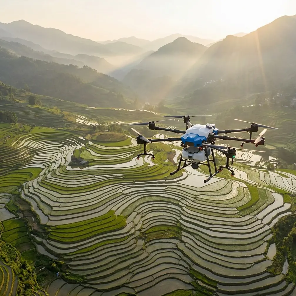
Agras T100 in Urban Field Tracking: What a Simple Training Scenario Reveals About Real Agricultural Operations
META: A field-focused case study on Agras T100 urban tracking, connecting drone swarm training concepts with wind and visibility realities that affect spray drift, route planning, and precision operations.
I still remember a site visit on the edge of a city where the field itself was not the hardest part of the job. The real challenge was everything around it.
A narrow agricultural plot sat between a service road, low industrial buildings, and a line of trees that funneled wind in unpredictable ways. The mission sounded straightforward: track the field accurately, plan repeatable passes, and prepare for precise agricultural work without wasting time in setup or risking drift toward adjacent spaces. Yet anyone who has worked near urban edges knows the truth. Boundaries get messy. Airflow gets strange. Visibility changes faster than operators expect.
That is exactly why the Agras T100 deserves to be discussed not as a generic “smart farm drone,” but through a more grounded lens: route discipline, environmental awareness, and what operator training really means when a field is surrounded by urban interference.
The overlooked lesson from a two-drone training exercise
One of the most useful reference points comes from an educational DJI training scenario, where operators are asked to use two drones in formation flight to plan a new route and complete a seeding task for a field. The same material scales that idea up further, proposing 3 to 6 drones for coordinated plant-protection work over farmland.
At first glance, that sounds far removed from a single Agras T100 operating on an urban-fringe parcel. It isn’t.
The significance of that exercise is not the exact aircraft count. It is the operational mindset behind it. The training emphasizes that field work begins with planned flight lines, synchronized movement, and task decomposition before the mission starts. In other words, precision agriculture is not just about what happens at the nozzle. It starts with how the operator thinks about space.
For Agras T100 users tracking fields in urban environments, that lesson matters more than many spec-sheet features. Urban-edge agriculture punishes improvisation. If your swath width assumptions are loose, if your turning pattern is inconsistent, if your route is built casually around obstacles, you create the conditions for overlap, skips, or drift-sensitive edge passes. The T100’s value shows up when the operator brings that formation-style discipline into a single-aircraft mission plan.
I often tell research teams and commercial operators the same thing: if an educational platform can teach route logic using two small aircraft over a model field, the same logic becomes even more consequential when a larger agricultural platform is working next to roads, buildings, and sensitive boundaries.
Why urban tracking is not just mapping by another name
People sometimes use “tracking fields” as if it simply means outlining a parcel on a screen. In practice, urban field tracking is a compound task. You are identifying true workable acreage, locating edge hazards, understanding how local air movement may alter application behavior, and building a route that can be repeated under real conditions.
This is where the weather reference becomes more than classroom material.
The aviation meteorology source defines wind speed by horizontal air movement over time, measured in m/s or km/h, and gives a practical wind scale tied to visible ground effects. At 12–19 km/h, flags extend fully. At 20–28 km/h, dust is raised. At 29–38 km/h, small trees begin to sway.
That progression matters operationally for the Agras T100 in an urban setting because spray drift does not care whether a field is technically “small.” Once dust is visibly lifting or tree lines are moving, the field edge becomes a decision zone, not a routine pass. The risk is magnified in cities and peri-urban districts because there may be sidewalks, parked vehicles, drainage channels, greenhouses, or non-target landscaping only a short distance away.
So when an operator talks about tracking a field with centimeter precision or maintaining a strong RTK fix rate, that precision has to serve a larger purpose. It is not enough to know where the boundary is. You need to know whether today’s boundary pass is operationally defensible under current wind.
The wind lesson most operators learn too late
On that urban-edge job I mentioned, the first route draft looked efficient on a tablet. Neat lines. Clean geometry. Good coverage on paper.
Then we stood still for thirty seconds and watched the site.
Dust lifted briefly from a side access lane. A row of ornamental trees bent in sequence, not uniformly, which told us wind was channeling between structures rather than crossing the field evenly. In meteorological terms, we were not just looking at “wind speed.” We were seeing how surface features were reshaping it.
The training references describe wind effects in a very practical way, with visible cues such as smoke direction, flag extension, dust movement, and small tree sway. That kind of cue-based judgment remains valuable even when operating advanced aircraft. The Agras T100 may bring better precision, better route repeatability, and a more capable agricultural workflow, but no professional should outsource environmental judgment to automation.
This has direct implications for:
- Spray drift management near built-up boundaries
- Nozzle calibration decisions when adjusting for conditions rather than ideal lab assumptions
- Swath width confidence in irregular edge zones
- Mission timing when a route is technically possible but operationally unwise
An experienced operator with a T100 should treat urban tracking as a live environmental reading exercise. The field map is static. The air is not.
What visibility has to do with route quality
The same meteorology material also breaks down visibility in a way that deserves more attention from agricultural drone teams. It defines visibility as the maximum horizontal distance at which a person with normal vision can distinguish an object against the sky background. The source then classifies conditions from 20–30 km, where the view is extremely clear, down to 0.3–1 km in fog, and even less than 100 meters, effectively zero visibility.
This is not academic trivia.
In urban agricultural operations, visibility affects more than pilot comfort. It changes how confidently an operator can verify boundary markers, monitor nearby obstacles, observe drift behavior, and maintain visual awareness of aircraft position relative to non-target areas. If field tracking is done under reduced clarity—even before true fog conditions—small interpretation errors can creep into the route design.
That matters especially when a parcel is broken up by utility margins, access roads, or landscaping buffers. A drone like the Agras T100 can fly a precise mission, but if the operator’s environmental read is poor at the planning stage, the precision simply executes a flawed assumption more accurately.
I have seen teams obsess over multispectral inputs and digital field layers while underestimating the value of plain visual certainty. There is a place for advanced sensing, and multispectral analysis can be useful for crop health interpretation. But in an urban tracking workflow, the first win is often simpler: verify the working area in conditions where the operator can actually see edge context clearly.
The real bridge between classroom drone swarms and the Agras T100
The educational document includes another detail that is easy to dismiss but operationally revealing: DJI’s TT formation kit was designed to simplify coordinated flight operations without requiring a router.
Why does that matter in a discussion about the Agras T100?
Because it points to a broader truth in agricultural UAV design: reducing setup friction is not cosmetic. It directly improves mission consistency. Every unnecessary setup step is another point where crews lose time, improvise, or accept suboptimal conditions because they are already committed to the day’s work.
In urban-edge agriculture, setup efficiency matters even more. Windows for safe operation may be short. Wind can build. Visibility can deteriorate. Nearby human activity can increase. A system that shortens the path from arrival to validated route execution has practical value beyond convenience.
This is one reason the T100 is best understood as part of an operational stack, not a standalone machine. Its strengths become more meaningful when the crew uses disciplined planning, solid RTK practices, careful nozzle calibration, and weather-aware timing. Centimeter precision is only useful when the mission itself has been structured well enough to deserve it.
A better way to think about precision
Precision in agriculture has been flattened into a slogan. In reality, there are different kinds of precision, and they do not all carry equal weight.
For the Agras T100 in urban tracking, I would rank them this way:
Boundary precision
Knowing exactly where the workable field begins and ends.Environmental precision
Reading wind and visibility honestly, using both instruments and visible site cues.Application precision
Matching nozzle behavior, route spacing, and speed to the actual conditions on site.Operational precision
Building repeatable workflows so one good mission is not a lucky exception.
The references support this hierarchy better than many product pages do. A two-drone seeding exercise teaches route discipline. A 3-to-6-drone plant protection scenario teaches coordinated coverage logic. The wind table teaches that visible environmental signs correspond to measurable risk. The visibility scale reminds us that “good enough to launch” is not always good enough to track and execute correctly.
Together, these details create a more honest picture of what high-level Agras T100 operation looks like.
What changed after we adjusted the urban field plan
Back to that field near the city.
We revised the route instead of forcing the first draft. Edge passes were reconsidered. The highest-risk side of the parcel was scheduled for a calmer window. We treated the tree line not as scenery but as a wind indicator. We used the field geometry more conservatively and focused on repeatability over apparent speed.
The result was not dramatic in the cinematic sense. No miracle moment. No exaggerated leap. Just cleaner operational logic.
And that is the point.
The Agras T100 makes difficult agricultural work easier when the crew respects the chain of decisions behind the aircraft. Tracking, route planning, environmental reading, and application control are not separate topics. They are one workflow. The operator who understands that will get more from the platform than the one who only talks about payloads and coverage.
If your own projects involve compact fields, urban margins, or sensitive neighboring land uses, it helps to discuss route planning and environmental fit before mission day. For operators comparing workflows or trying to refine field tracking methods, this direct Agras T100 discussion channel can be a practical starting point.
The bigger takeaway for Agras T100 users
The most valuable insight from the reference materials is not hidden in a flashy claim. It sits in plain view.
A simple training exercise asks operators to plan a seeding mission with two drones. A scaled scenario expands to 3 to 6 drones for plant protection. A meteorology lesson explains that by 20–28 km/h wind, dust begins to rise, and by 29–38 km/h, small trees sway. Visibility can range from 20–30 km of clear sight down to less than 100 meters.
Those are not disconnected facts. They form a practical doctrine.
Plan first. Read the air honestly. Respect what the site is telling you. Then let the aircraft’s precision do useful work.
That is how the Agras T100 becomes more than an advanced agricultural drone for urban field tracking. It becomes a reliable tool in a workflow shaped by judgment, not optimism.
Ready for your own Agras T100? Contact our team for expert consultation.